Rhine Castles Trail (Rheinburgenweg)
A personal record of my walk of the Rhine Castles Trail (Rheinburgenweg) with a written journal and with photographs. Tracklogs for GPS units and for use with Google Earth are available for download for each stage.
Journal, Photographs and Download Files
Stage Eleven - Oberwesel to Bacharach
Google Maps Open Source Maps| Statistics and Files | ||
|---|---|---|
| Start: Oberwesel | Finish: Bacharach | Distance: 8.2 miles (13.2 km) |
| Time: 4-5 hours | Climbing: 217 metres | Rating: Moderate |
| GPX Route File | Google Earth File | About the Rheinburgenweg |
| Statistics | |
|---|---|
| Start: Oberwesel | Finish: Bacharach |
| Distance: 8.2 miles (13.2 km) | Time: 4-5 hours |
| Climbing: 217 metres | Rating: Moderate |
| GPX Route File | Google Earth File |
The Walk:
 Ready for the off from Oberwesel
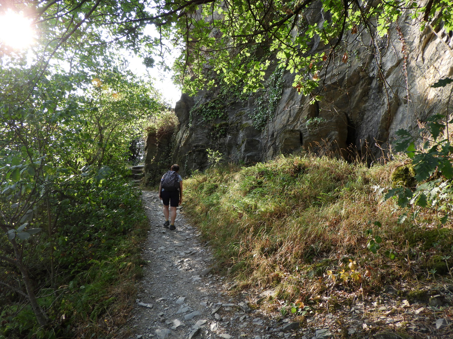 The climb to Burg Schönburg
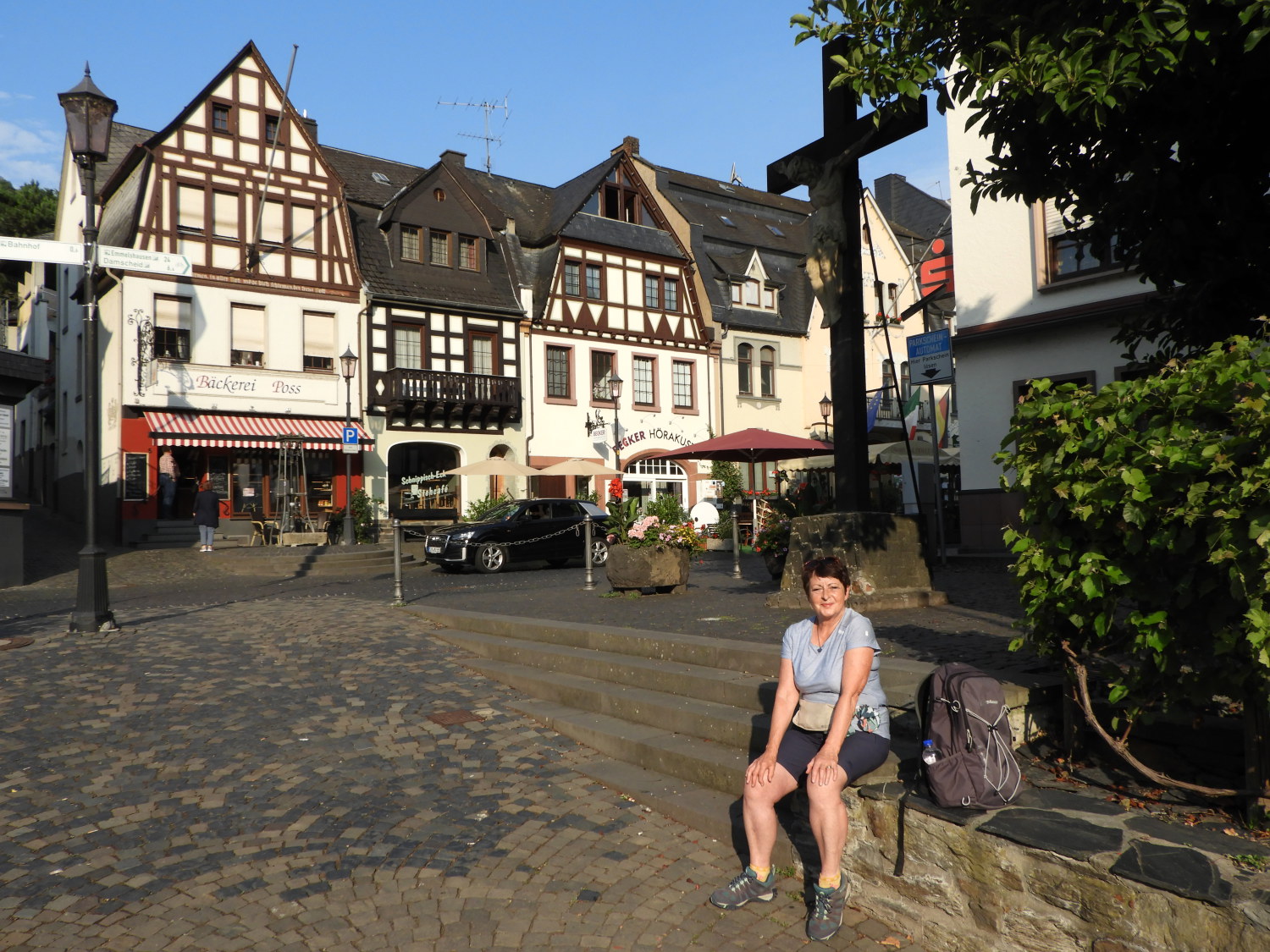
The familiar theme continued in Oberwesel, a bright and warm morning waiting for us to vacate our accommodation to begin the next stage of our walk. As usual, after the earliest breakfast possible, we were on our way. Hoping to get the climbing out of town done before the temperature rose into the thirties and towards to forties. We had seen our first target from the Marktplatz at the very start. Burg Schönburg stands high on an elevated rocky outcrop to the south of Oberwesel, looking over the town with protective assurance. It is quite a sight. Getting to the castle was not easy. First we had to work out which streets to follow to find the path leading up to the castle. And once that was achieved we had a steep climb facing us. Lil, now acclimatised to the walk, proudly set off on the climb ahead of me.
 Liebfrauenkirche and Oberwesel
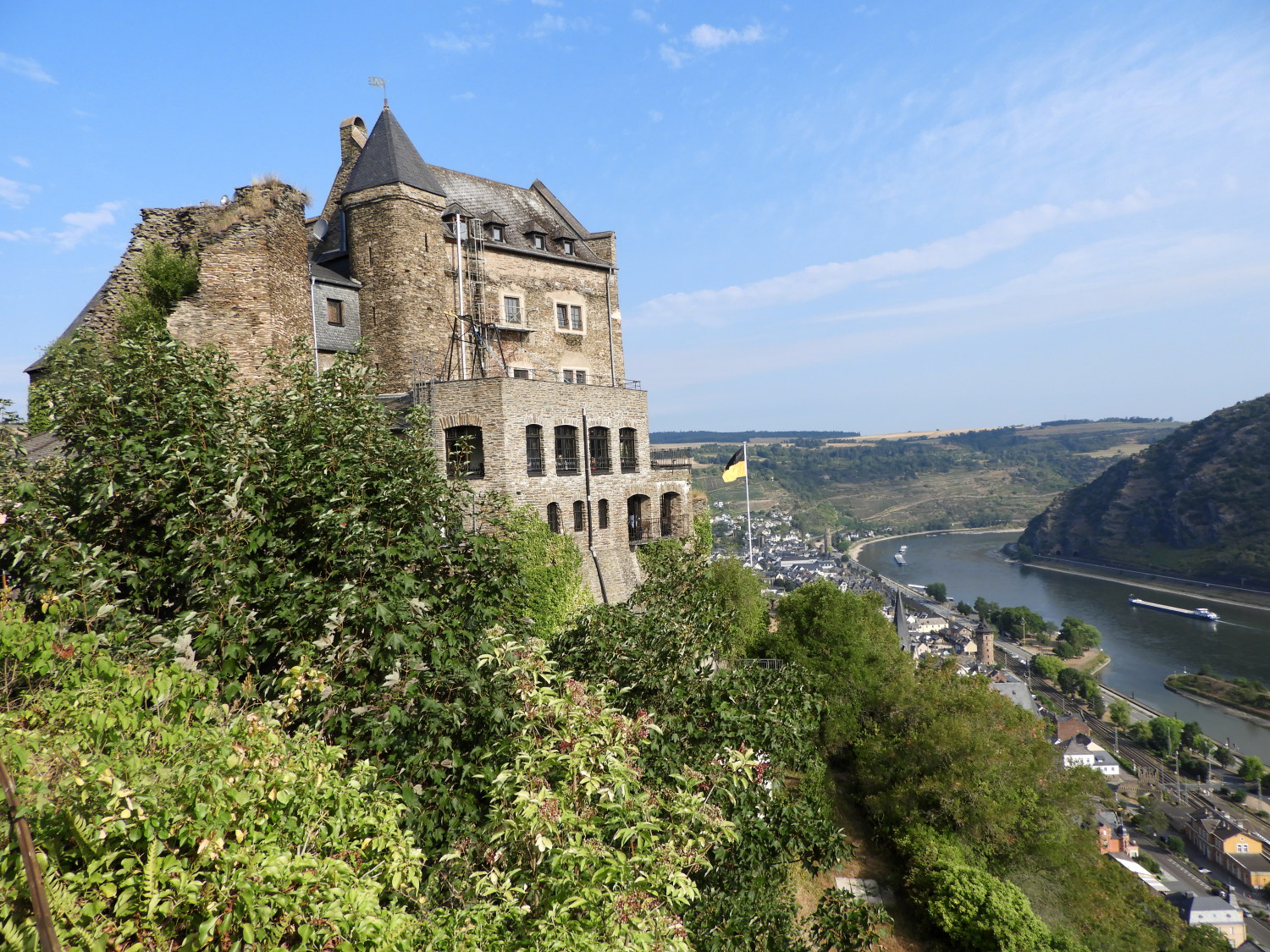 Burg Schönburg and Oberwesel
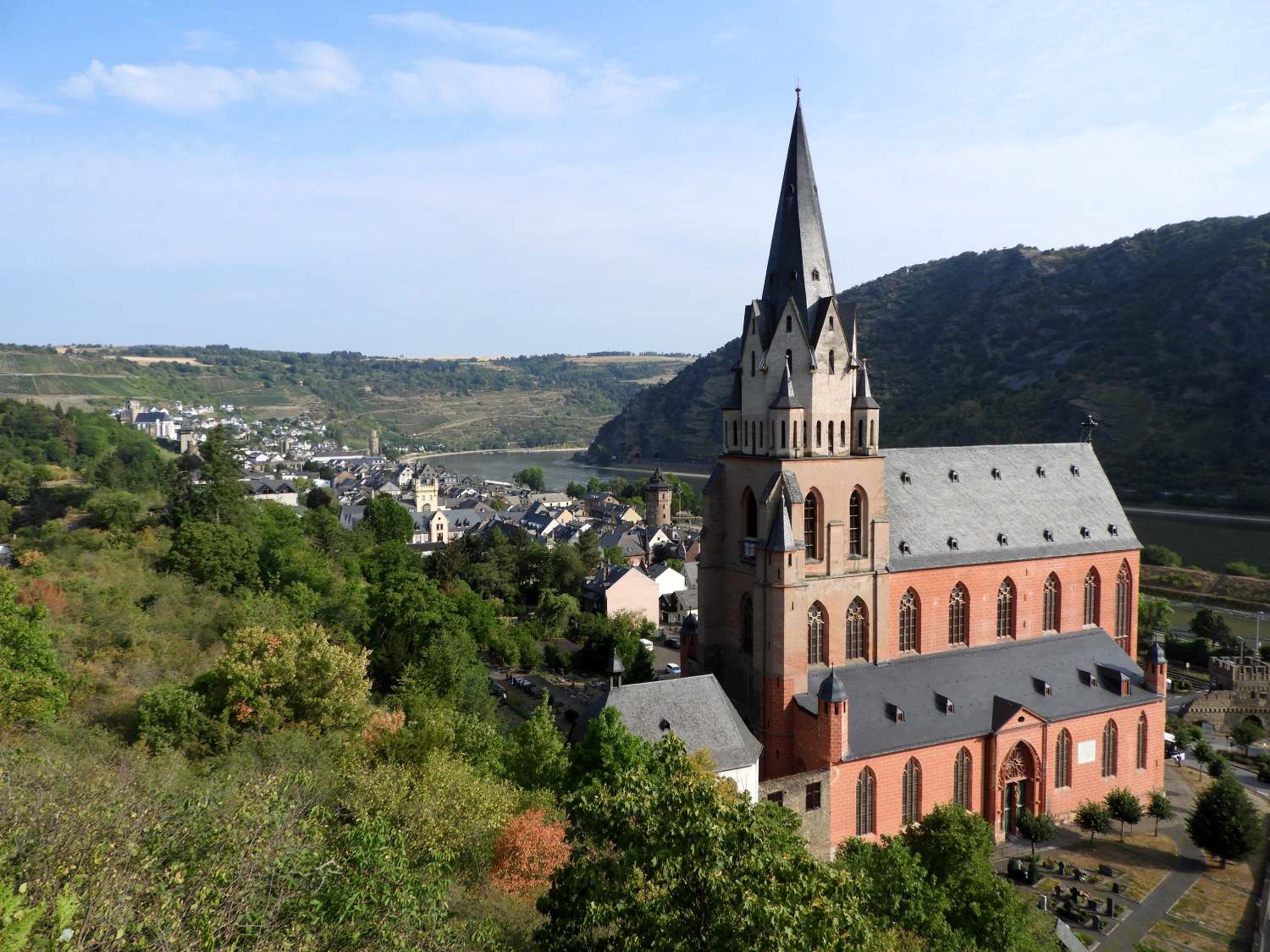
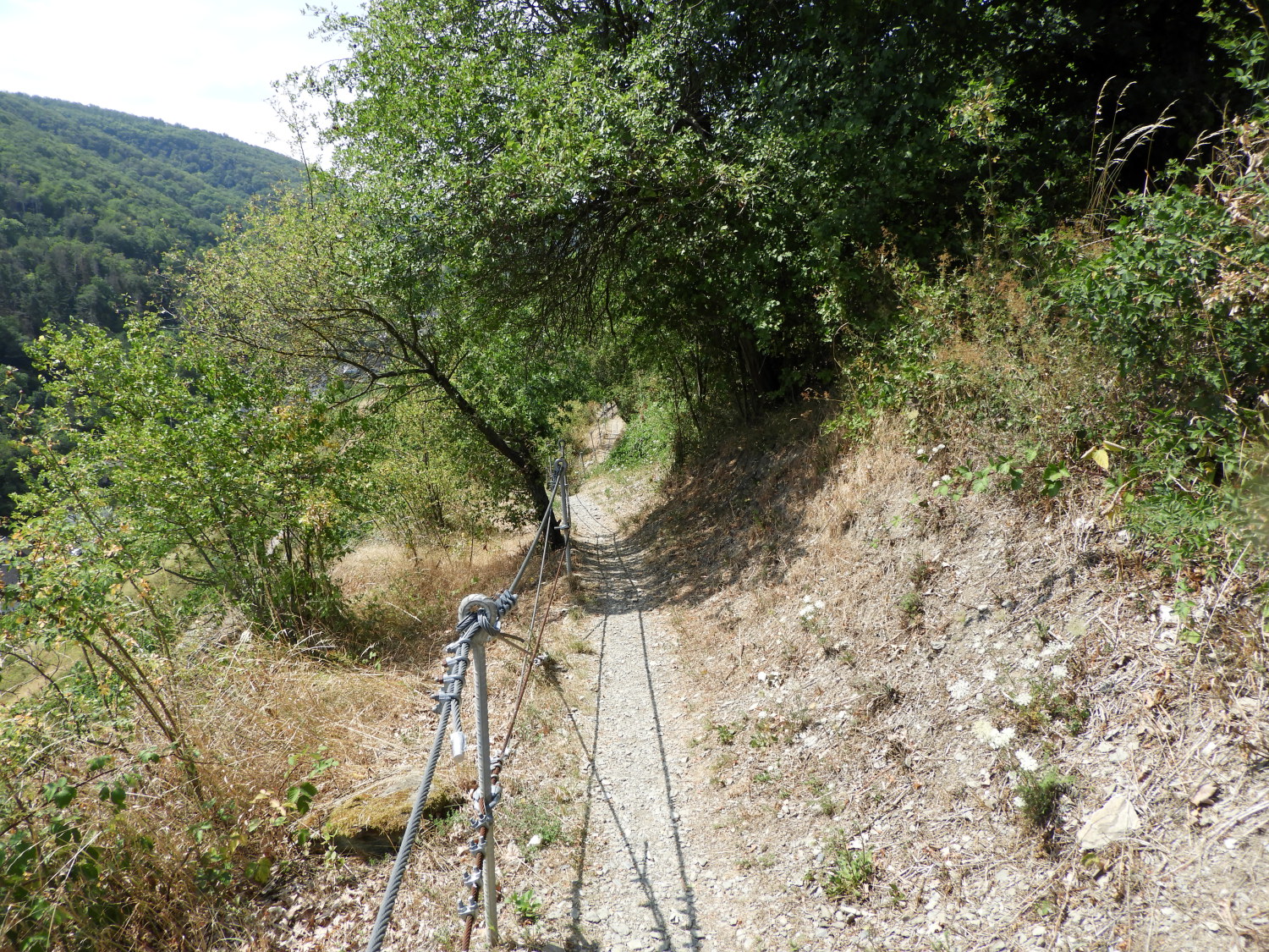
The path up to the castle was on a narrow headland of rock, jutting out towards Oberwesel and widening to support Burg Schönburg further up. In places, with no earth to form the path, it was cut out of the rock. Metal barriers were placed by the path side at the most precarious places to avoid terrible accidents, such was the possibility of falling from the path. With the combination of steepness, our age (just turned pensioners!) and the weight we carried on our backs we took the climb seriously and made our way up most carefully. Then, just to demonstrate the daring adventure of youth, we spotted movement from behind and stepped out of the way. A young man ran up the path and in a moment was out of sight. In our brief break while he came and went we took the opportunity to look down on the magnificent red brick building of Liebfrauenkirche. I thought it sounded like a well known wine and church, appropriate for a popular wine growing area.
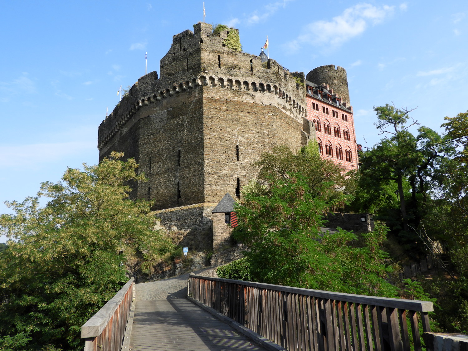 Burg Schönburg
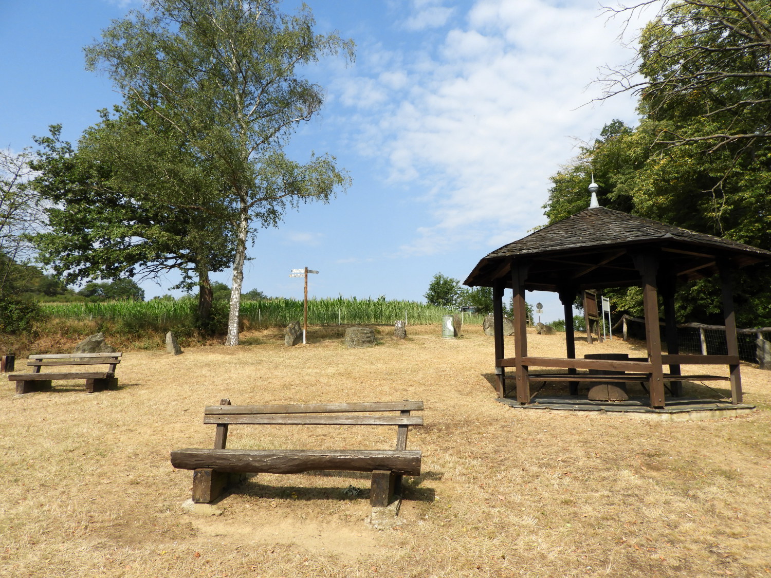 Traumschleifchen Pfalzblick
At Burg Schönburg we met a gentleman who was a custodian of the castle museum. He gave us a brief history lesson of the castle which, though much improved upon over time, is over 1,000 years old. Making it one of the oldest sites of a castle in the Middle Rhine. Burg Schönburg, like so many others, is now a hotel and restaurant. From the castle we walked on with more ease than that with which we had arrived, have completed the early steep climb of our day. Off we went, on path and quiet road, towards Traumschleifchen Pfalzblick, a picnic area which gives a wonderful view of the Rhine valley stretching south towards the town of Kaub. Just beyond Kaub is Falkenau island in the centre of the Rhine, on which a castle stands. Pfalzgrafenstein Castle is another of the fairytale type. A real beauty.
 On the road at Endebach
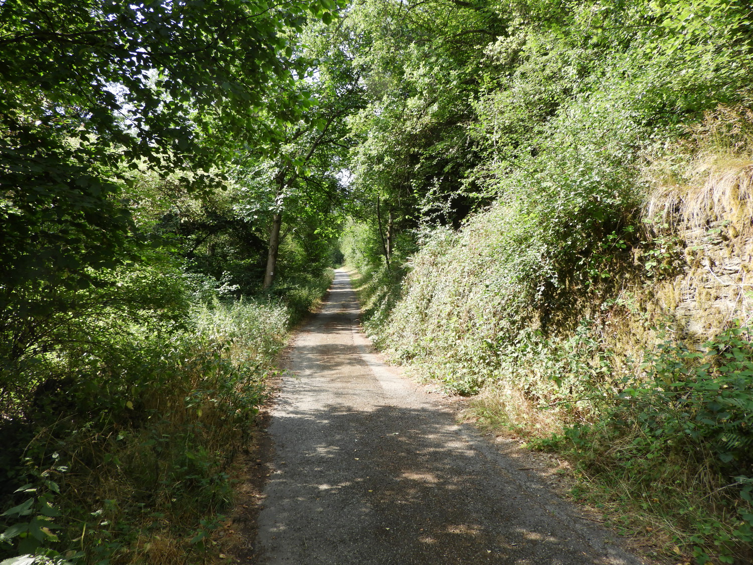 Long and straight on the Elligbach
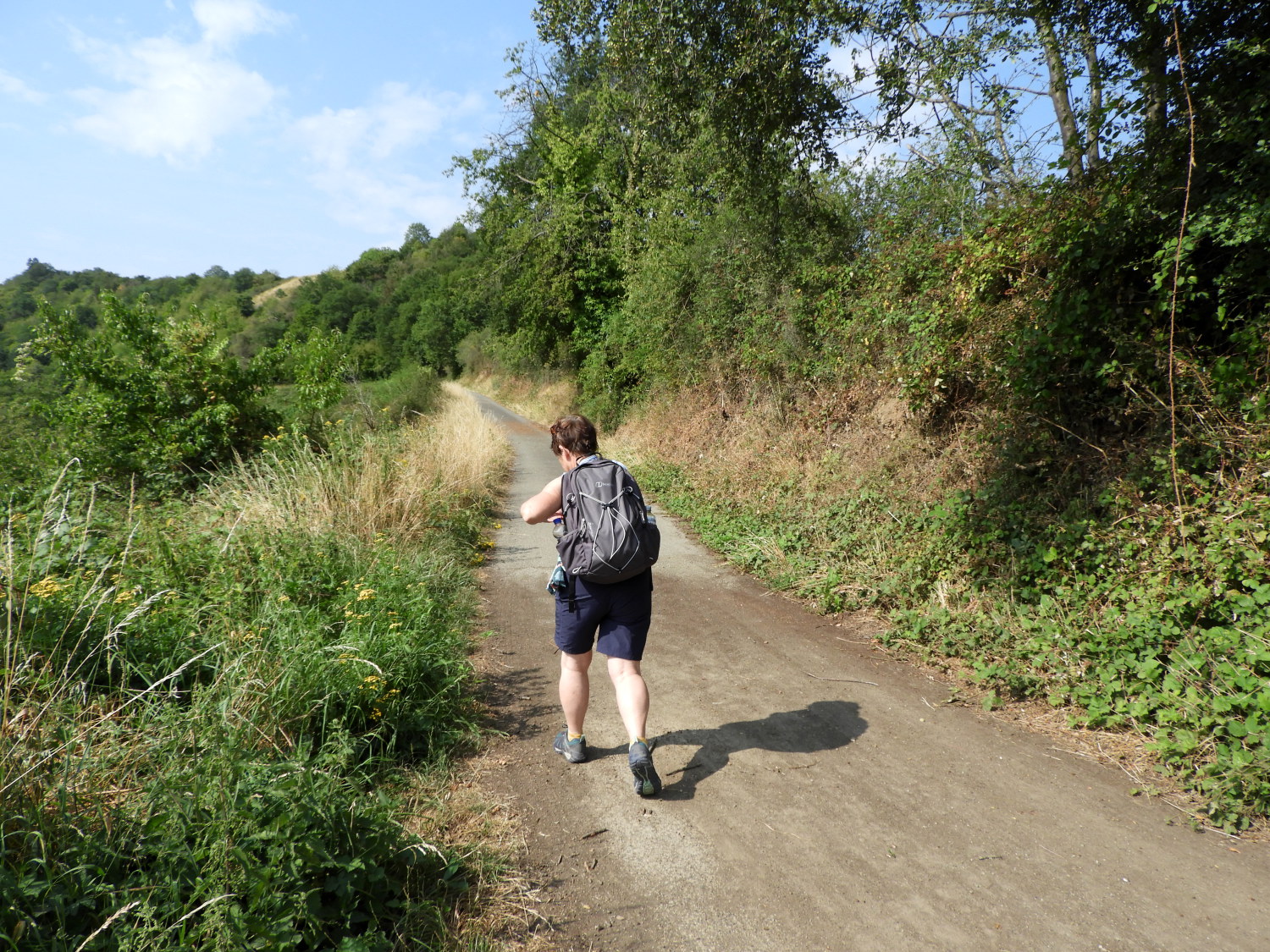
Today we had decided to divert a little from the Rheinburgenweg to visit a couple of small villages and take in a flavour of quiet rural life near the Rhine. To get to them I mapped the route on quiet lanes following the Elligbach upstream. On the way we had a humorous diversion with a couple of Yellowhammers. They were hopping along the path about thirty metres ahead of us and every time I stopped to try to take a picture they would jump into the grass at the side of the path. Then when I put the camera down out they would pop again. This went on for a while. The best I got was of them hopping away up the road.
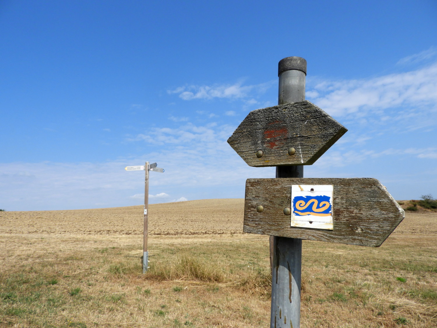 A sign and field near Langscheid
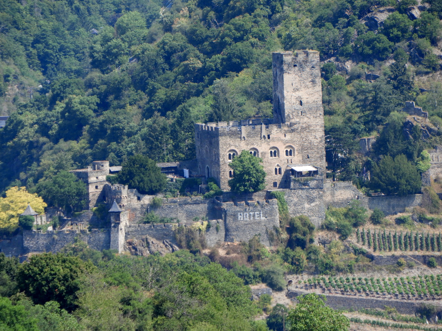 Burg Gutenfels
The first of the two villages we arrived in was Langscheid. Here, one of the first things we came to was a small triangular road sign with an image of a Hedgehog. It was nice to think these delightful at risk animals are cared for here too. Other notable sights in Langscheid were a Deutz tractor, probably as old as me, an impressive village church, seemingly too big for such a small village. And a big furry cat walking down the street. People? Not one to be seen. Though it was now after eleven in the morning and getting very hot. They were probably staying cool in the houses behind the closed wooden window shutters. From Langscheid we headed a short way by roadside towards the neighbouring village of Henschhausen, on the way getting the best view of Burg Gutenfels standing above Kaub in the Rhine valley.
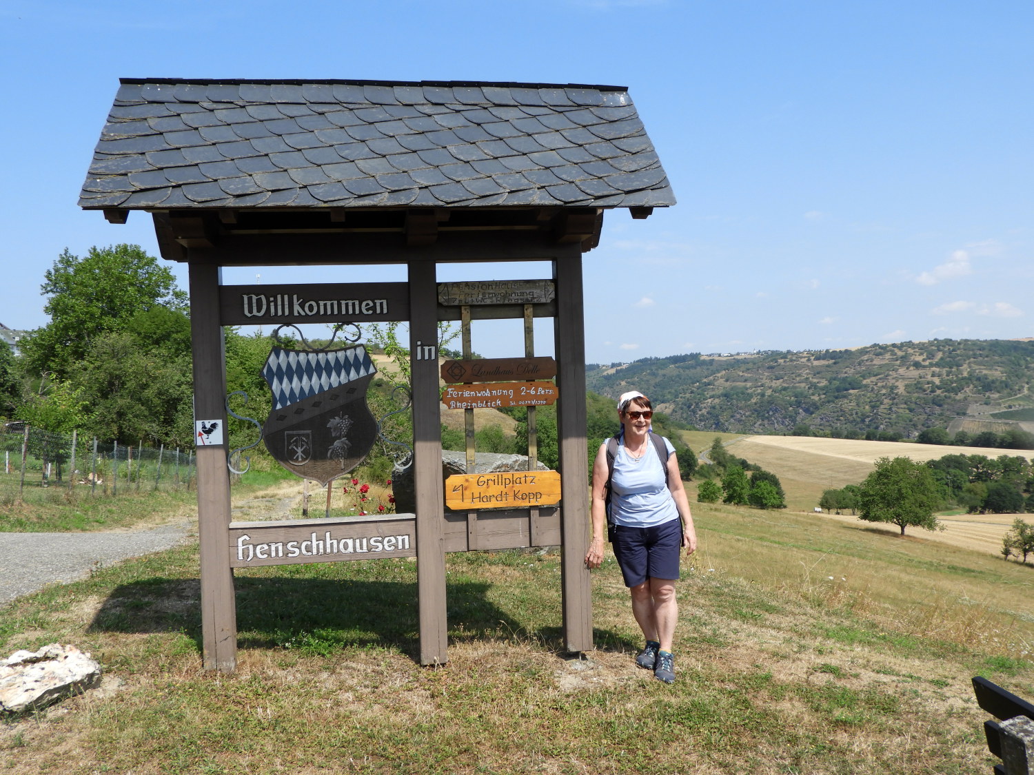 Willkommen Henschhausen
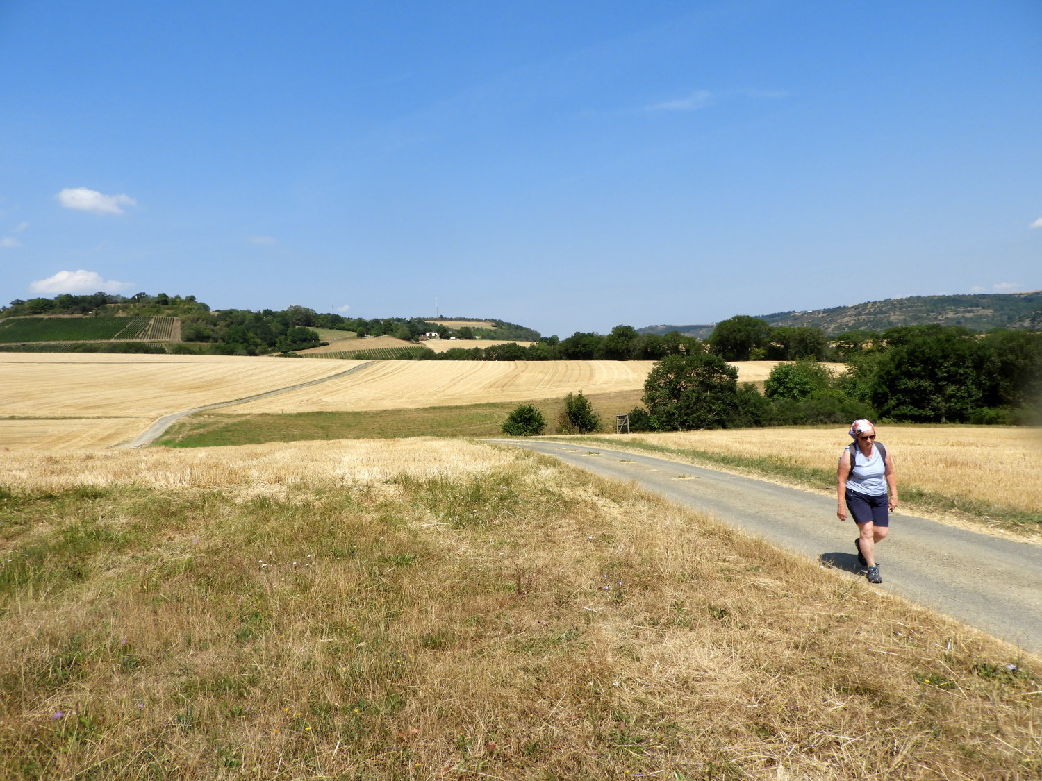 Walking in the heat of the day
We stopped for a sit down and to rehydrate on a bench by the Bushaltestelle, (bus stop) in Henschhausen during which time a lady came across with a bucket to fill it up with water at the village well. While she did so a gentleman approached from the opposite direction, briefly talking with her until she returned the way she had come. The man stayed by the well and I asked "Können wir das Wasser trinken?". Though he understood, saying "Nein" my struggle with the diction and my dialect made him sense we were English. Next, there followed one of those delightful mixed English and German conversations between us; the man talking of his liking for England on visits he had made in the past. Lil and I mentioned our love of Germany. It was a nice chat with a lovely man, much like that we had enjoyed with Eckhard and Christian Stelzer in Weiler. In fact, during our time in Germany we found the people most delightful, friendly and accommodating. Everyone we encountered had time for us.
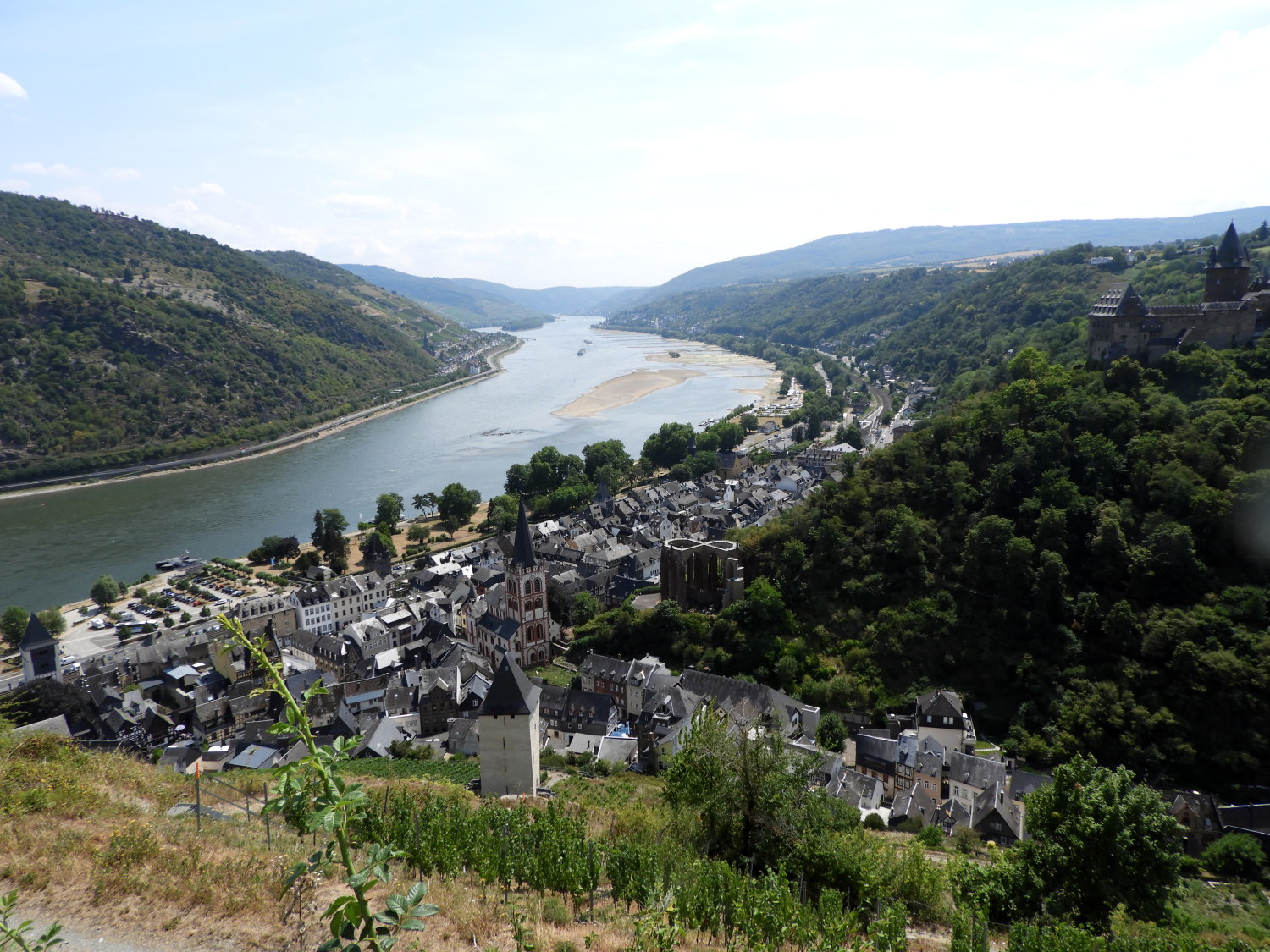
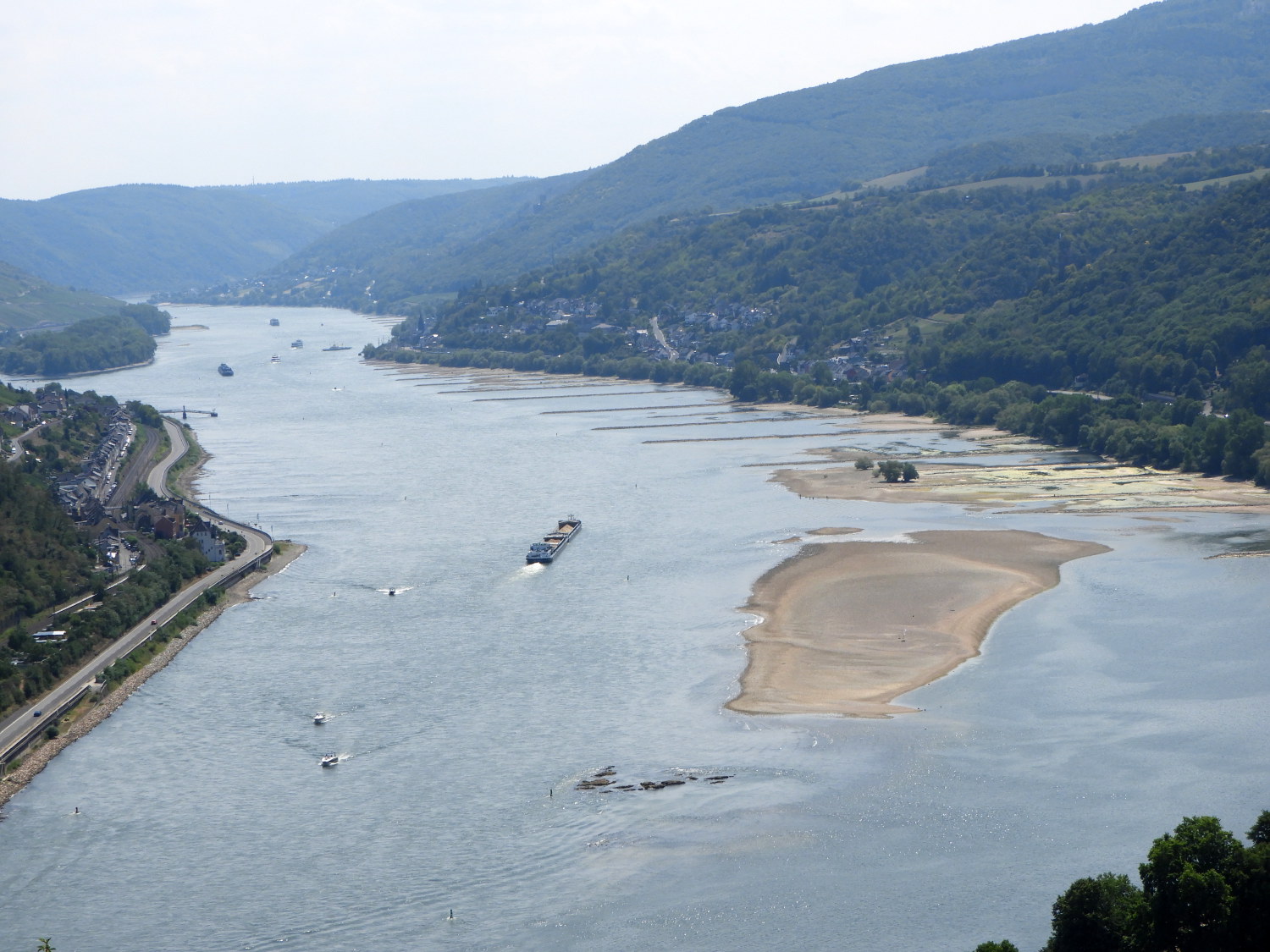 Sandbanks in the Rhine
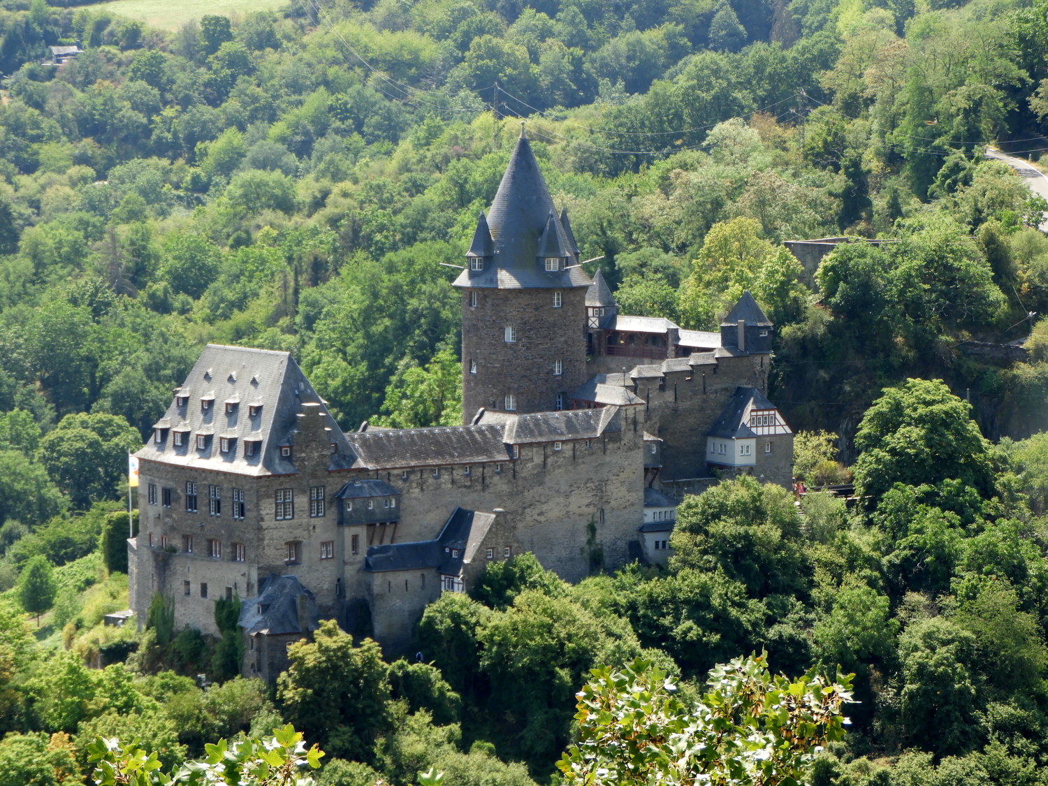 Burg Stahleck
From Henschhausen we made our way back onto the Rheinburgenweg. The path, now a farms access lane, passed between wide golden grain fields leading to green fields of vine. Walking between the rows of fattening grapes led us to the edge of the hills overlooking the Rhine and the town of Bacharach, our destination today. As well as the town, which is one of the prettiest on the Rhine, two sights took our attention. First, was the number of sandbanks showing in the dwindling Rhine, with barges, boats and cruisers negotiating their way around them. A couple of weeks later, in a rare event, parts of the Rhine were closed to all river craft due to the low water in this hot dry summer. Second, our eyes were led to the sight of Burg Stahleck on the west side of the town. It was an impressive site surrounded by woodland on an elevated rock platform. We would be visiting the castle at the beginning of tomorrow's stage of the walk.
 Bacharach
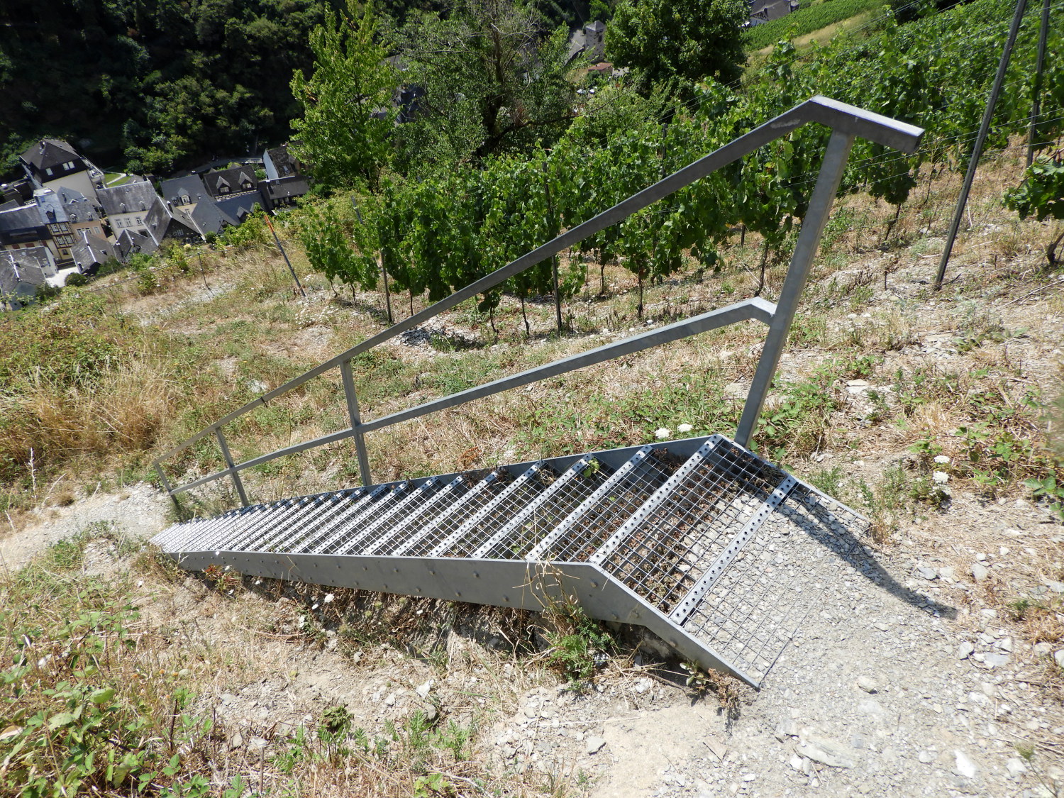 Staircase down the steep slope to Bacharach
Though we could now see Bacharach and even make out the rooftop of our hotel on Blücherstraße it looked a long way down. And it was, about 130 metres of descent to be made for us to get there. The descent started with a steep series of steps in the ground, winding down like a snake. Part of the way down these the steps edged beside a crumbling wall. A good deal of the wall was now on the steps; making a foothold was not easy. Extreme care was needed to not slip. That was just a foretaste of what came next, an aluminum staircase leading us down another very steep section. It was hard work going down towards Bacharach.
 The steep descent part two
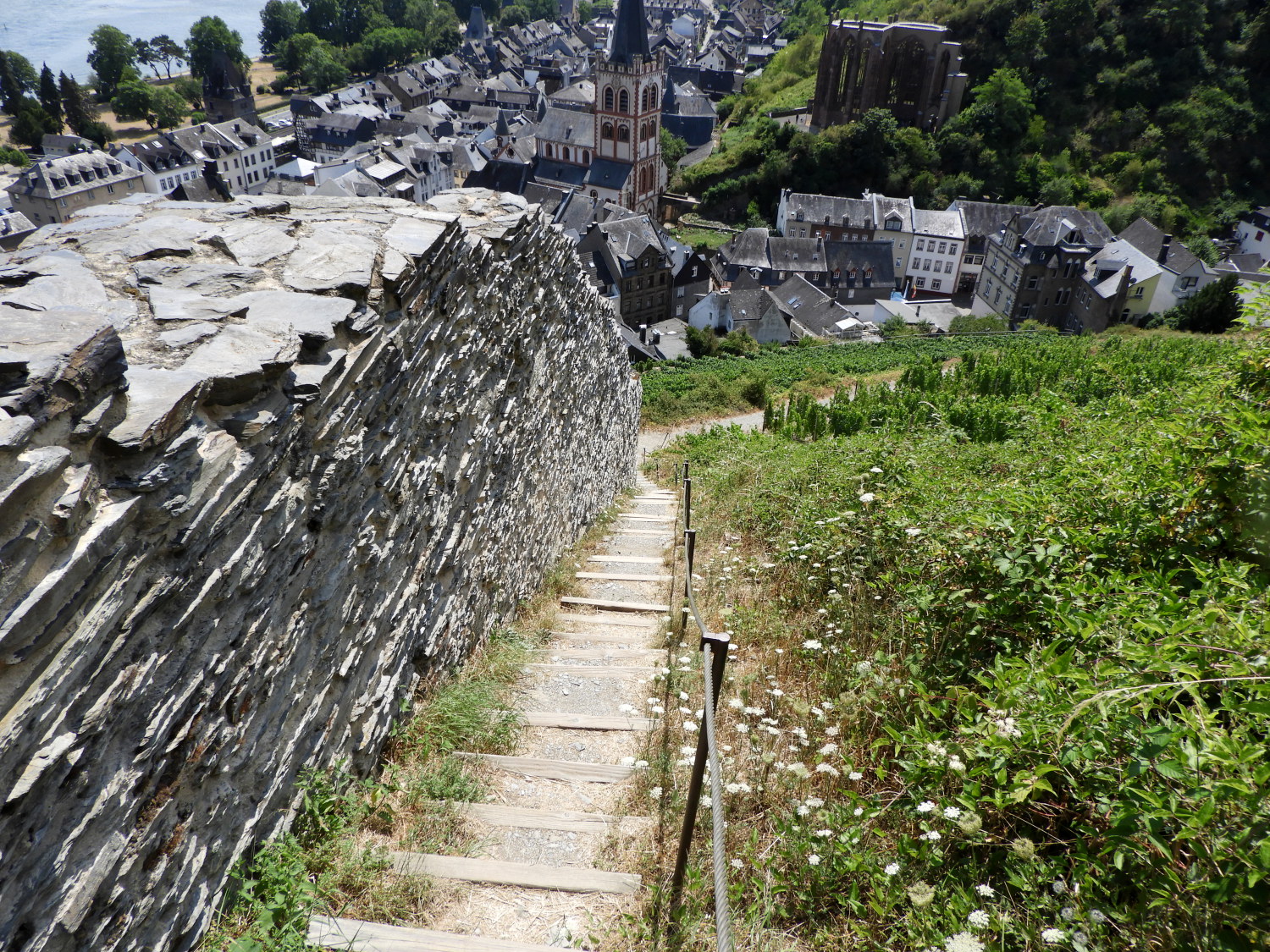 The end of the hard descent is in sight
We were not done with the descent then. Just about half way. We took respite at a viewpoint above Spitzer Turm, the remains of a tower which was blown up in 1689 by the soldiers of the French Sun King Louis XIV. Here, one of those lovely curved wooded benches gave Lil a moment to relax. Then off we went on steep descent part two to the finish of this stage of our Rhine Castles Trail, edging down a stepped path beside the north side city walls. Three structures captured our eyes on the way down. The aforesaid Burg Stahleck, the Ruine Wernerkapelle and the Postenturm.
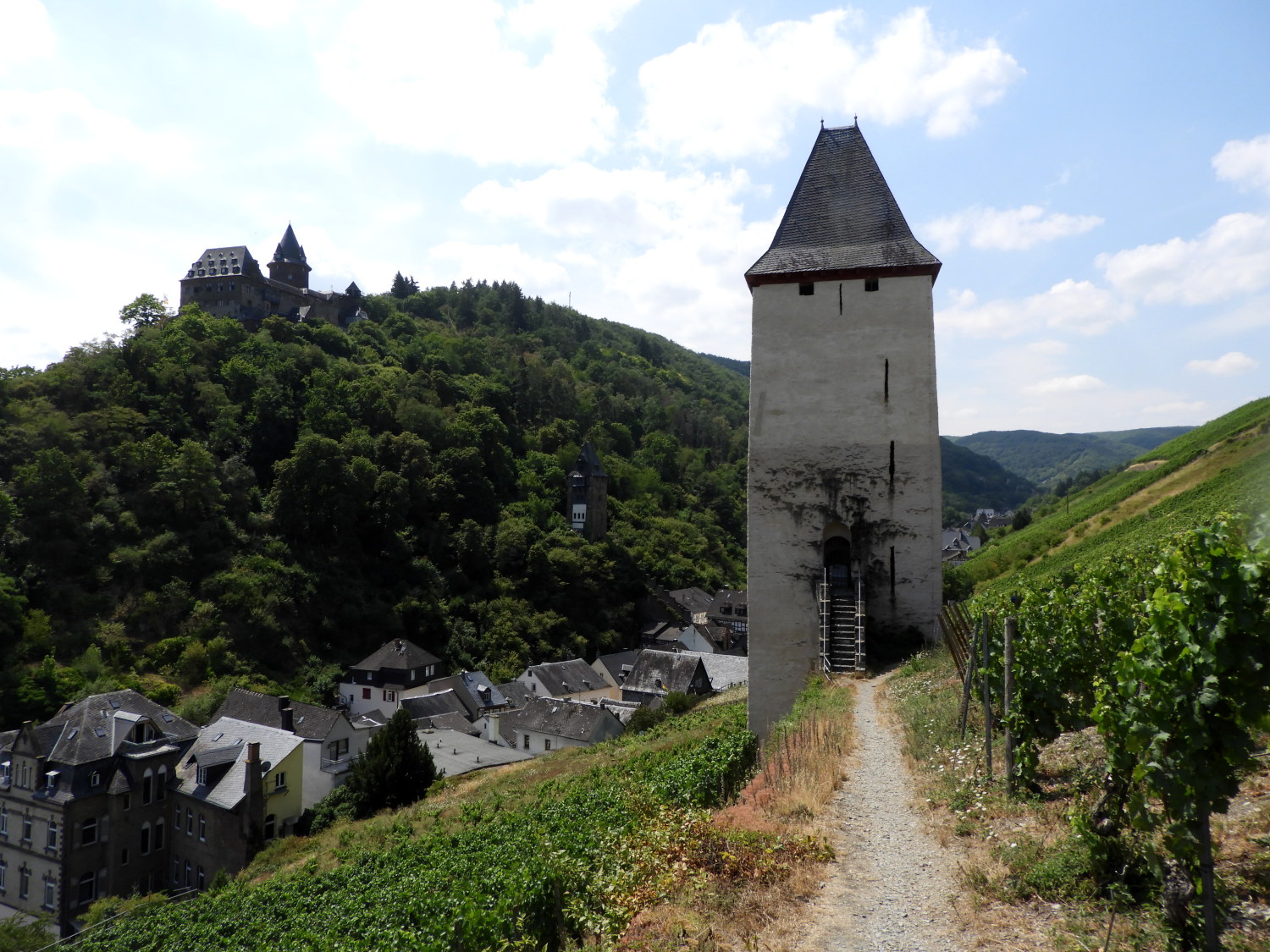 The Postenturm, Bacharach
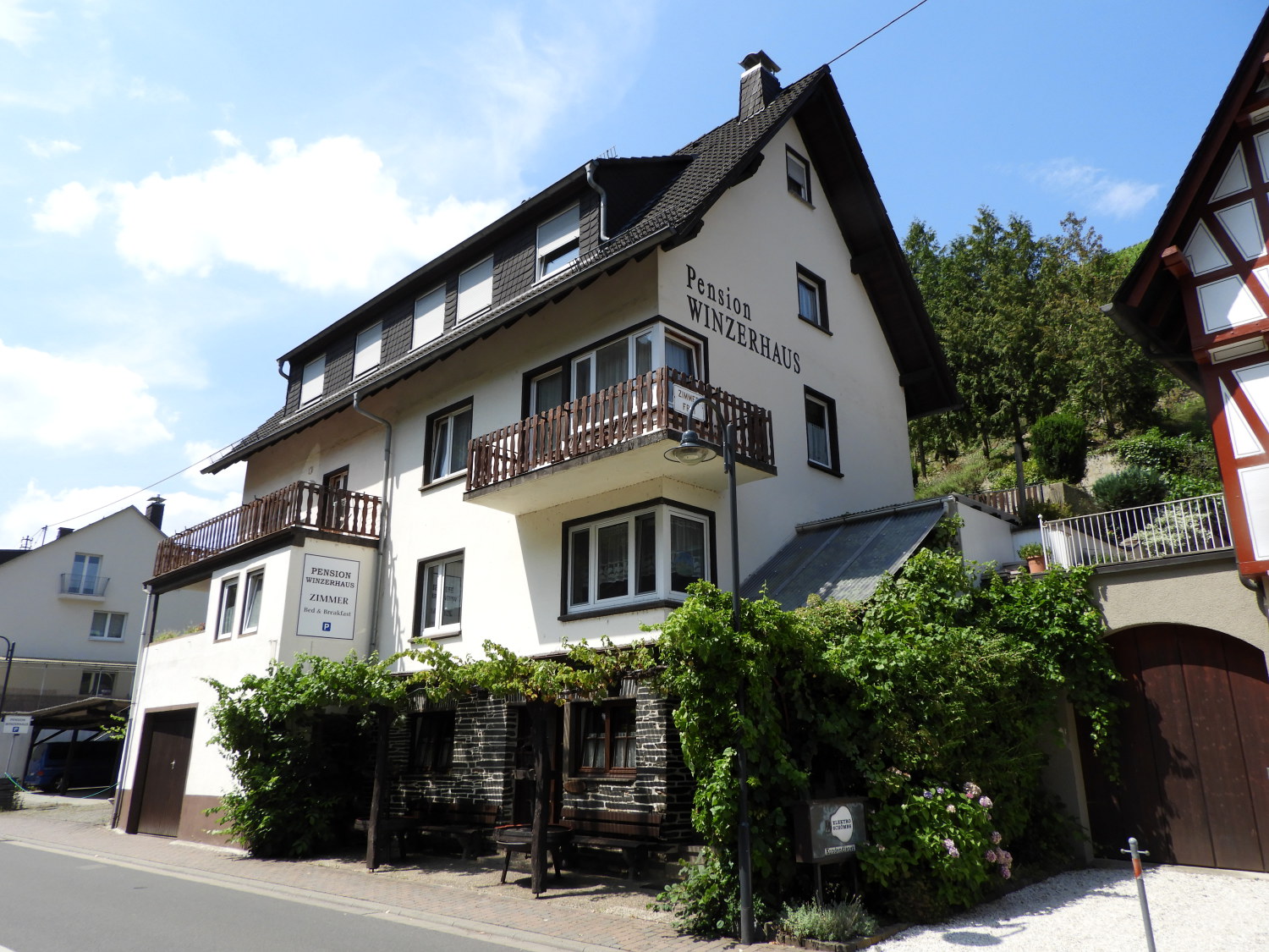 Our accommodation in Bacharach
After the steep descending, on the easier approach to town, we walked directly towards the Postenturm. Once part of the city's fortifications, the Postenturm is a tower affords panoramic views from the top. The viewpoint is reached by scaling 58 steps which I was tempted to do but there was already a group of people up there. So Lil and I walked on by and on to Blücherstraße where we found our accommodation. After checking in, dropping off the backpacks and having a quick freshen up we went out to explore the beautiful town of Bacharach. It was around 2.00pm, time for afternoon tea.
Lil and I would like you to meet Stopsy. Let me tell you about Stopsy. Before Lil agreed to join me on the Rhine Castles Trail I had to make a promise. She had said "I don't want you walking off and leaving me behind on the path. Like you tend to do sometimes on our walks together. Promise me you won't". I had promised not to do so. And when we set off on the first climb of the walk from Rolandsbogen at the very start of the walk I said to her "You know my promise of not walking off into the distance. Well here goes. All you have to do is say 'Stopsy' and I will stop dead. And I will not move until you say 'Gosy'. How is that for a plan". She was delighted and ever since then I have stuck to the pledge. As has happened, she has not had to overuse the instructions. But now and again I will hare off ahead just to wait for the call of 'Stopsy'. Anyway, after high tea and cake in Bacharach this afternoon we browsed the shops and Lil added to her Steiff Bear's collection. "What are you going to call this one" I asked. "Stopsy, of course. Say hello is Stopsy".


