The Great British Walk
A personal record of my three month walk of the full length of Great Britain from north to south with written journal and photographs. Tracklogs for GPS units and for use with Google Earth are available for download for each stage.
Stage 50: Eaton Dovedale to Rugeley
Google Maps Open Source Maps| Statistics and Files | ||
|---|---|---|
| Start: Eaton Dovedale | Finish: Rugeley | Distance: 16.5 miles (26.5 km) |
| Time: 7-8 hours | Climbing: 250 metres | Total Distance: 676.4 miles |
| GPX Route File | Google Earth File | About Staffordshire |
| Statistics | |
|---|---|
| Start: Eaton Dovedale | Finish: Rugeley |
| Distance: 16.5 miles (26.5 km) | Time: 7-8 hours |
| Climbing: 250 metres | Total Distance: 676.4 miles |
| GPX Route File | Google Earth File |
Ordnance Survey Explorer Map (1:25,000)
Summary
I have to be honest and say this was one of the more forgettable of the 77 days walking from North West Scotland to South West England. Steve and I followed the Staffordshire Way on this stage, without deviation for almost 16 miles until we reached Rugeley. We could have expected well maintained paths with accessible gates and stiles on the Staffordshire Way. What we experienced was far from what we expected including the path skirting around fields it should have crossed and electric fencing fixed to some stiles. They were good points to the walk which I will deal with in the commentary but I wish to make it clear from the start that the Staffordshire Way was a disgrace.(Note: My walk of the Midlands was a part of my Great British Walk from the north coast of Scotland to the south coast of England)
Stage Report
It was an overcast morning but it was dry and warm, much like the recent mornings we enjoyed while walking through the Peak District. Leaving the National Park had been one of the milestones I had marked in my mind before setting off on this journey. I classed it as the end of the passage through the north of England. Now I was into the Midlands phase of the walk which would take six days before I reached Chipping Campden in the Cotswolds. This Midlands phase would be dominated by two long distance paths, firstly the Staffordshire Way which Steve and I joined yesterday and which we would follow all through today and secondly the Heart of England Way which would see us past Birmingham. And so, on this overcast morning we upped camp and tidied up the site on Mr Bamford's land before walking on.
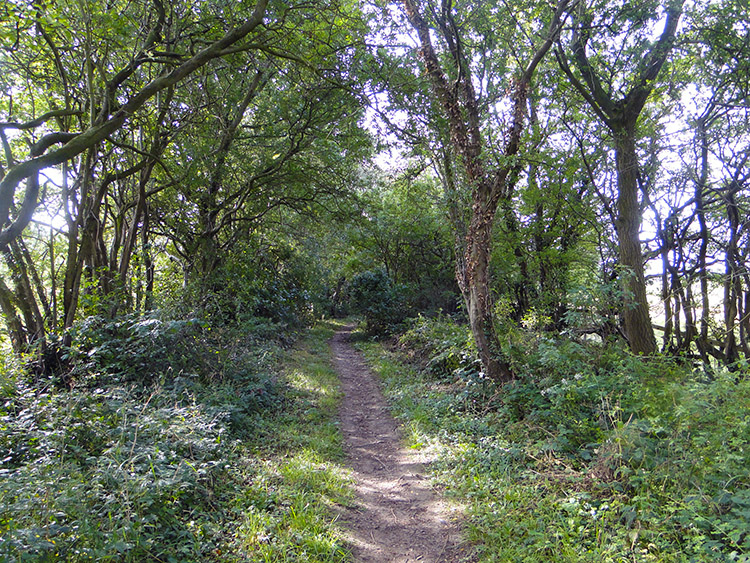
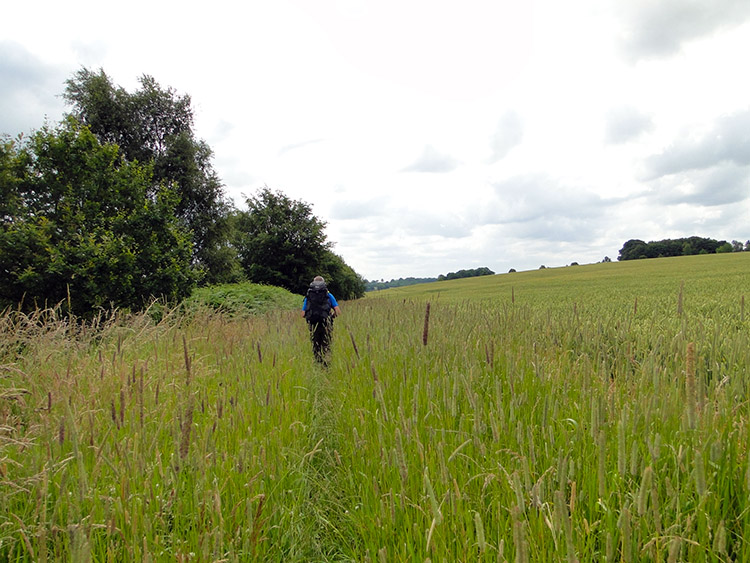
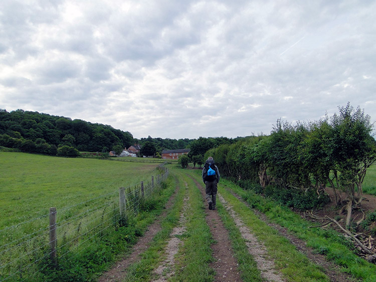 Setting off
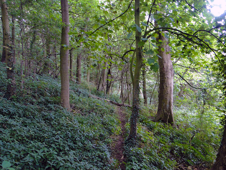 Sidford Wood
We crossed two fields on the plains of the River Dove while walking away from the home of Mr JCB before reaching Eaton Hall Farm, the home of Doveridge Clay Sports. Here we saw all the clay pigeon shooting paraphernalia and a few unbroken clays which had be missed by the less competent shooters. We read a sign nearby which said "Doveridge Clay Sports and Corporate Leisure: A very warm welcome to our grounds". Immediately below it was less than welcoming by stating "You are about to enter a shooting ground. Shooting is in progress when the red flags are flying. Keep to the designated footpath at all times. Thank you". We were early at just 7.30am. There were no flags. There was no sound of shooting. In fact all we could hear was the early morning cooing of actual pigeons. I bet there were pleased the shooters only trained their sights on the clay pigeons.
Continuing on from the farm we left the river plains which we had followed all the way from Rocester to climb through Sidford Wood. The wood is on the steep eastern side of the Dove Valley and that meant that while we were on the Staffordshire Way we had actually crossed into Derbyshire. In fact we had crossed back into Derbyshire way back in Rocester when we crossed the road bridge to the east side of the River Dove. So ever since we had joined the Staffordshire Way we had in fact been back in Derbyshire.
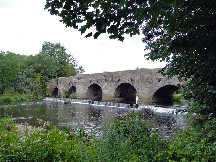 Dove Bridge on the A50
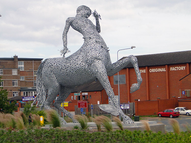 The Centaur by Andy Scott
After clearing Sidford Wood we crossed a field while losing the 25 metres of height we had gained while climbing through the wood to reach Dove Bridge which allows the A50 trunk road to cross the River Dove. When crossing over to the other side of the river we would get ourselves back into Staffordshire. On reaching Dove Bridge I recalled the times I had crossed the bridge while commuting during work. I tried to put the horror of that out of mind which I easily did by trying to find out how the Staffordshire Way went across to the other side of the A50. In fact Steve and I tried for quite a while to fathom it out. First we tried going under the most direct arch to where we had arrived by the riverside but that took us nowhere. Eventually by rummaging around we found a sign by the bridge which took us up onto the new road which we crossed by the footway with traffic hurtling by at goodness knows what breakneck speed before leaving the road by a gate and following a footway cum cycleway to another sign leading us through a gate indicating the way to the Willows Water Meadows which would lead us into the town of Uttoxeter.
The Water Meadows were a short run of low lying fields, nothing special at all. While crossing them we passed close to Uttoxeter Racecourse and then we walked down a scruffy lane near to the railway station which led us to the A518. In the centre of a roundabout on the main road was a sculpture of a Centaur. It was the best thing we saw in Uttoxeter but then we did not head for the town centre, instead following the Staffordshire Way through the suburbia of Balance Hill. Our walk through Uttoxeter was easily forgettable.
 Leaving Uttoxeter by Timber Lane
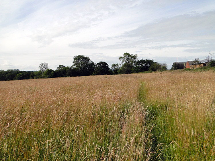 Finding the path to Scounslow Green
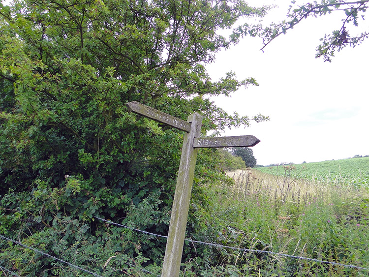
The immediate walk from Uttoxeter was very pleasant, along the tree lined avenue appropriately called Timber Lane. Soon the trees were left behind as we crossed a mix of pasture and arable fields on a course due south. As well as the fields we passed Knightsfield Farm and Knightsland Farm. While walking this stretch the first signs of Staffordshire Way neglect showed. There we few signs pointing the way through or along the sides of fields so we had to check map and GPS every time we came to one. And in the arable fields with crops there had been no effort made to provide the path which should be done on a permissive right of way. The odd walker who had been here ahead of us had shown the way by leaving a faint trail through the crops.
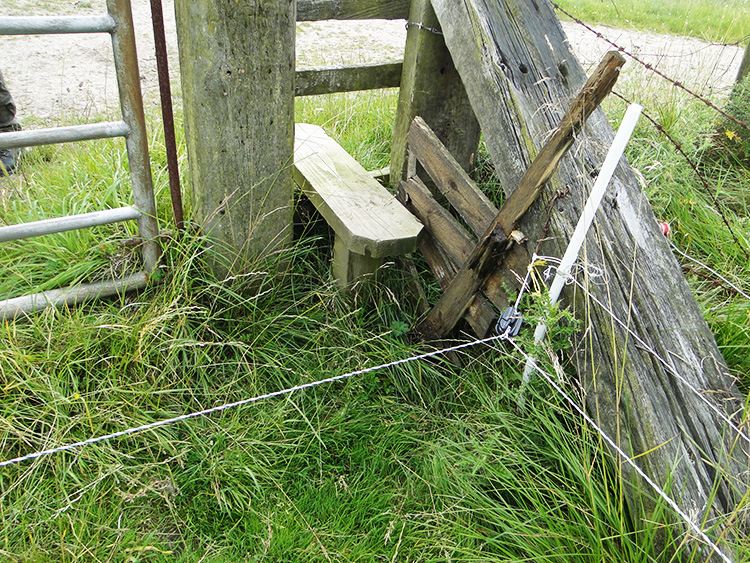 Clear electric hazard to access stile
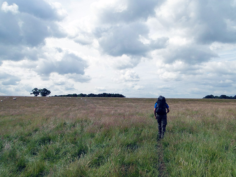 Bagot's Park
In the field after Knightsland Farm which the path diagonally crossed we parked ourselves down just before we reached a road and took our first break of the day. It was 9.30am. We had been walking for a little over two hours and we had covered five miles. After the break we crossed the road, followed a lane, crossed a field and then another road to reach Hanging Wicket Farm. Then followed another mishmash of field crossings to New Thorntree Farm before another road crossing and then another mishmash of fields led us to Marlpit House Farm. Let the fun begin.
We came to a stile crossing in the grounds of the farm with a Staffordshire Way indicator sign clearly showing the way. The only problem was that we had to carefully hop over an electric fence near to the stile to get to it. It took some contortions but we managed it. Then we crossed a couple of fields with a place called Parkstile nearby to reach another field boundary which would lead us across the big fields of Bagot's Park. Here there was another stile with a Staffordshire Way sign telling it was the right one. And beside it was another electric fence, this one actually fixed to the stile. Getting over the stile without touching the electric wiring was something akin to a Crystal Maze challenge. I thought "surely enough is enough, that must be the end of it".
 Path untended
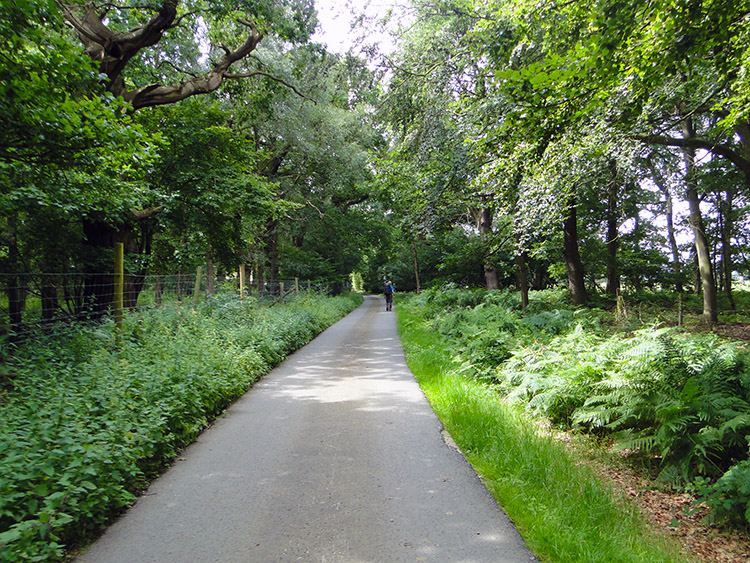 Lane through Bagot Forest
After the gymnastics of the stiles with electric fencing challenges Steve and I were faced with a long walk along the sides of two large fields in Bagot's Park leading us to Storybrook Plantation from where we would continue on much the same to the village of Abbots Bromley. That was the plan. However we began following the path which proved so difficult to walk. Grass had grown high and it was thickly spread. Not just by the side of the path but on the path too. Walking the Staffordshire Way through Bagot's Park on the official line was like wading through treacle. "This Staffordshire Way walk is crap" said Steve as he struggled through the thick vegetation and I had to agree with him. The path followed the line of Story Brook to Storybrook Plantation in much the same manner and once at the plantation we looked at the Staffordshire Way path going on and on, unmanaged and unforgiving. At the plantation a path crossed the way, one route leading to a road through Bagot Forest to the village of Dunstal. I showed the map to Steve. "Bugger this for a game of soldiers, let's go this way" I suggested to him. He did not need asking twice.
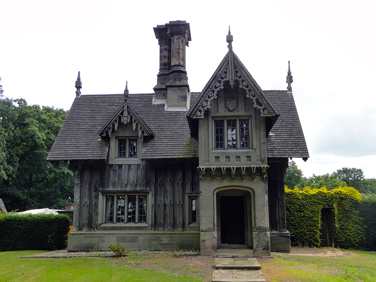 Goat Lodge, once the home of Phil Drabble
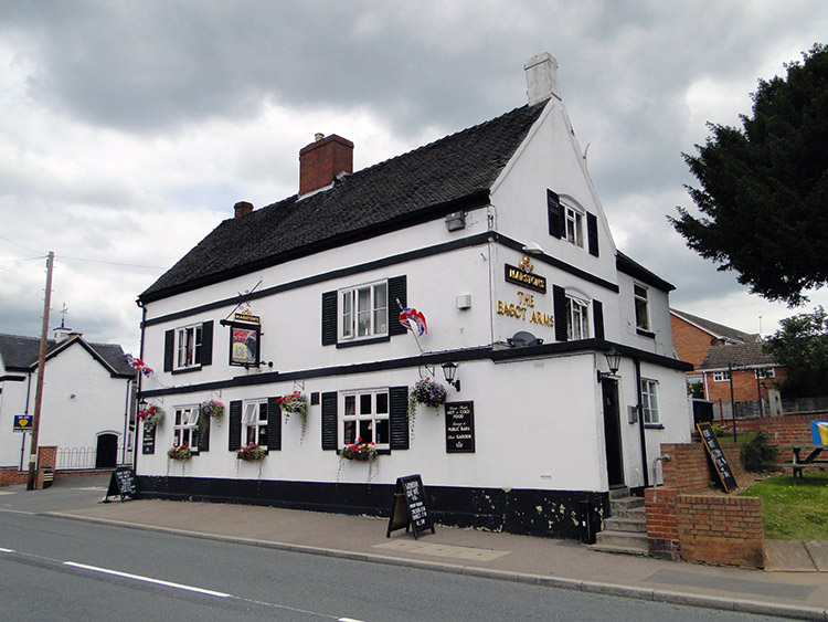 The Bagot Arms, Abbots Bromley
We were relieved to get to the hard tarmac of the lane through Bagot Forest after the struggle of the Bagot's Park jungle. Part way along the lane leading us to Dunstal and further to Abbots Bromley we came to an eccentric looking wooden framed house. Though we did not know it at the time we had arrived at Goat Lodge, the former home of Phil Drabble, the writer and television presenter. He was most famously known for being the original host of the TV series 'One Man and His Dog'. I have since found out that when he died and having never had any children, he left the house to Ruth Froggatt, his Personal Assistant of 25 years. Oh, wait a minute please, my mobile phone is ringing.
I had forgotten to mention in all the excitement of the walk. A few days ago I had been contacted by Sarah Freeman, a reporter from the Yorkshire Post newspaper. She had been made aware of my walk by friends and as a result she wished to interview me for a piece which would feature in the newspaper. Naturally I was flattered and she happened to call just as I was looking at Phil Drabble's former home. So I asked Steve to wait while I sat down in the entrance to Goat Lodge to be interviewed. The chat with Sarah took about 40 minutes during which time Steve sat patiently and i took questions such as why I began walking, how I planned the route, my love for Great Britain, etc. See the result of the interview in the story 'Nagging doubt that led to trek through Britain' which featured in the Yorkshire Post on Wednesday 20 July 2011.
Following my interview Steve and I walked down the road from Goats Lodge past Little Dunstal Farm and Dunstal Hall Farm and into the gorgeous village of Abbots Bromley. It is a regular entrant and sometime winner of Staffordshire Best Kept Village Competition and it has also been rated the best place to live in the Midlands by the Sunday Times. We could clearly see why. It was so tidy as we walked through with lovely gardens and flowering hanging baskets all over the place. There was not a shred of litter to be seen. It was so nice that while we had not intended to we stopped in the village for a short break. I popped into the Crown pub and bought two pints of Orange and Lemonade. We enjoyed them while sat on a bench in the main street. Next to us was a lovely rounded shelter and set in the grass nearby was a sign which read "Best Kept Village: Community Council of Staffordshire".
 Staffordshire Way sign to nowhere
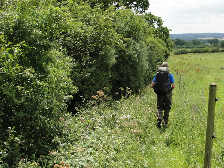 Hemmed in by Barbed Wire
Phil Drabble's old home and Abbots Bromley were undoubted highlights crammed into the middle of a stale old bread Staffordshire Way sandwich. What had gone before with electric fences and walking through course long grass in which we could have done with a machete was followed by more dissatisfaction. Soon after leaving the beauty of abbots Bromley we reached Blithfield Reservoir. A sign leading to Blithfield Sailing Club which led on further across the reservoir dam was the way Steve took while I decided to follow the official Staffordshire Way on the outfall side of the dam wall. It was the proper thing to do as Steve's way was not official while mine was. But fate led to him having it easy and me finding it impossible to follow the official route.
I followed the Staffordshire Way down below the dam wall and to the first field. As I began to cross it I spotted a herd of cows and then I spotted the Bull. It fixed eyes on me and stared threateningly. No way was I crossing that field. I looked left and hopped over a fence into the next field. Big mistake. It was a bog. Still, I stubbornly waded across it to the far side and already jiggered after the effort of wading across the bog I wearily and clumsily found a way over a course hedge to reconnect with the Staffordshire Way again. Not a good part of the way though. A sign near to me was toppling though neglect and pointing into the air. I could not fly where it was sending me so I took my GPS line instead which led me back to Steve who was resting on the far side of the dam. When I struggled up to him he said "Where have you been, I have been sat here ages" and adding "I just walked over the dam wall path and these two guys said carry on, no problem". I told him about the detoured caused by my encounter with the Bull while we carried on across a corn field towards the village of Colton. Such fun it was.
 Colton House
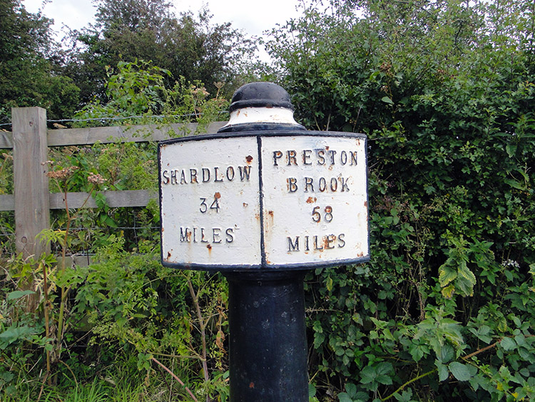 Milepost on Trent and Mersey Canal
The hurdles the Staffordshire Way threw our way were not quite over. The field between Park Bank Farm and Pool Farm forced us to walk a narrow line between a hedge to our left and barbed wire to our right. The path between began with decent clearance but half way through the hedge edged out to touch the fence. We were forced to clamber under the barbed wire and into the field for the rest of the way. Why do the landowners do it? Spite or downright laziness?
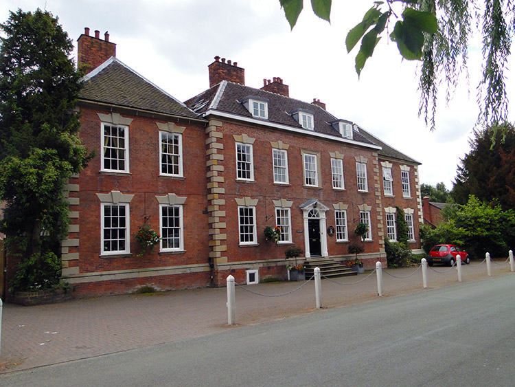
Clear of the fields and seething a little with a pique of anger we reached Colton and calmed ourselves down. While in the village we were greeted by some Shetland Ponies in a paddock, these ones not displaying the stubbornness associated with the breed. They were friendly. Then we passed the headquarters of the Border Collie Trust of Great Britain. They you go, we did not expect to see that in such a small unassuming village. Continuing on though Colton we passed Colton House, a rather posh Georgian House serving as an upmarket Bed and Breakfast and then we left the village by following a road and then a lane to reach the Trent and Mersey Canal.
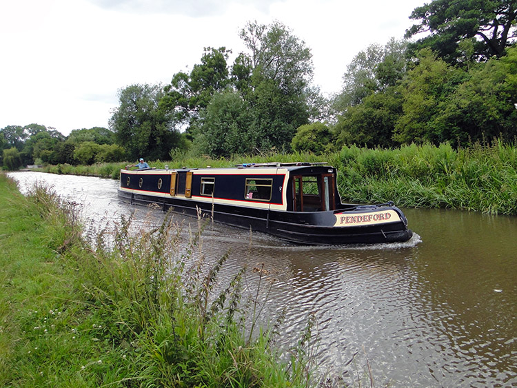 Narrowboat on Trent and Mersey Canal
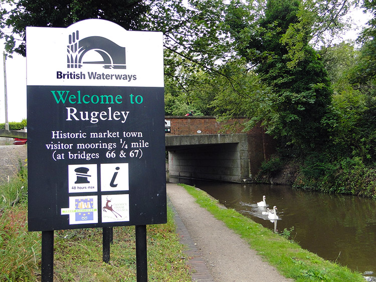 Welcome to Rugeley
The walk along the Trent and Mersey Canal into Rugeley was a grand finale and perfectly fitting for the completion of the 50th stage of my Great British Walk. We followed the Staffordshire Way along the towpath into the heart of the old town. Without impediment too which was a blessing after what had gone on before during the day. Passing along the way watching Narrowboats slowly pass by. We passed information signs beside the canal bridges too. One read "You are at Brindley Bank Aqueduct. Bridge 68 nearby is also one of James Brindley's original bridges. The site of the 'Bloody Steps' Christina Collins was murdered and legend says in 1839, her body was carried up the steps to the Talbot Inn". James Brindley was one of the most notable engineers of the 18th century. Christina Collins was an unfortunate innocent lady who met a tragic end in circumstances which inspired Colin Dexter to write 'The Wench is Dead' an episode of the Inspector Morse television series.
And so we walked further along the towpath of the Trent and Mersey Canal to the end of our walk, into the suburbia of Rugeley beside the canal with back gardens falling down to the canal side. Some householders were tending their gardens and others were working on boats moored in the canal at the bottoms of their gardens. some were just sat on canal side. decking watch the canal world float by. Or walk by as in our case. Eventually we left the canal and walked into Rugeley to find our hotel. We did so spot on 4.00pm.
We had plenty of time for settling in to our hotel room after a nights camping, to watch Deal or No Deal to which Steve was hooked, to freshen up and to go out for a few beers. We needed it to wash away the memories of the horrible Staffordshire Way. There were good parts to the walk and memorable moments like my interview with the Yorkshire Post, walking through the beauty of Abbots Bromley and the lovely finale along the Trent and Mersey Canal. But there were bad, horribly bad parts too. Electric fences, unmanaged paths, wayward signs, bogs and to cap it all a threatening bull stood barring my walk on the Staffordshire Way. Ah well, better luck tomorrow.


