The Great British Walk
A personal record of my three month walk of the full length of Great Britain from north to south with written journal and photographs. Tracklogs for GPS units and for use with Google Earth are available for download for each stage.
Stage 54: Chadwick End to Stratford Upon Avon
Google Maps Open Source Maps| Statistics and Files | ||
|---|---|---|
| Start: Chadwick End | Finish: Stratford Upon Avon | Distance: 14.7 miles (23.6 km) |
| Time: 6-7 hours | Climbing: 258 metres | Total Distance: 736 miles |
| GPX Route File | Google Earth File | About Baddesley Clinton |
| Statistics | |
|---|---|
| Start: Chadwick End | Finish: Stratford Upon Avon |
| Distance: 14.7 miles (23.6 km) | Time: 6-7 hours |
| Climbing: 258 metres | Total Distance: 736 miles |
| GPX Route File | Google Earth File |
Ordnance Survey Explorer Map (1:25,000)
205 Stratford-upon-Avon, Evesham and Alcester
Summary
The 54th stage of my Great British Walk was spent crossing lovely countryside in the rural heart of South Warwickshire. On the walk I made my way from Chadwick End by following the Heart of England Way through Baddesley Clinton and on to Rowington before leaving the way to track south on good paths to meet the Monarch's Way for the first time in Langley. From Langley I followed the Monarch's Way to my days end in Stratford Upon Avon.(Note: My walk of the Midlands was a part of my Great British Walk from the north coast of Scotland to the south coast of England)
Stage Report
After nineteen stages of enjoying Steve's company he was gone. Having planned to walk with me for all of the England part of my Great British Walk an unforeseen problem at home caused him to leave me for a while. It was a pity and I was sorry to see him having to rearrange his plans after completing a little over 300 miles of walking with me. However we agreed to meet later on into my walk and after he had sorted things out at home. So for the time being I was back to being a solo long distance walker.
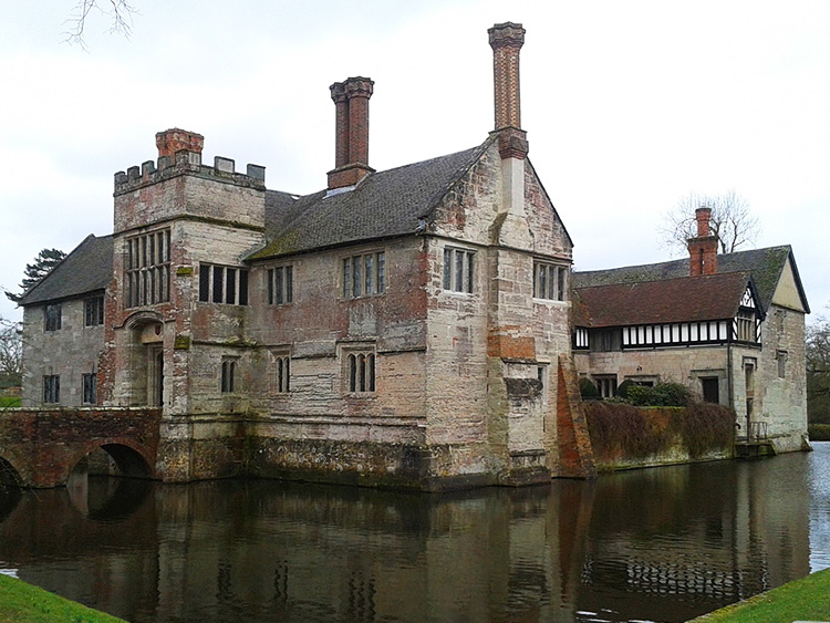 Baddesley Clinton House
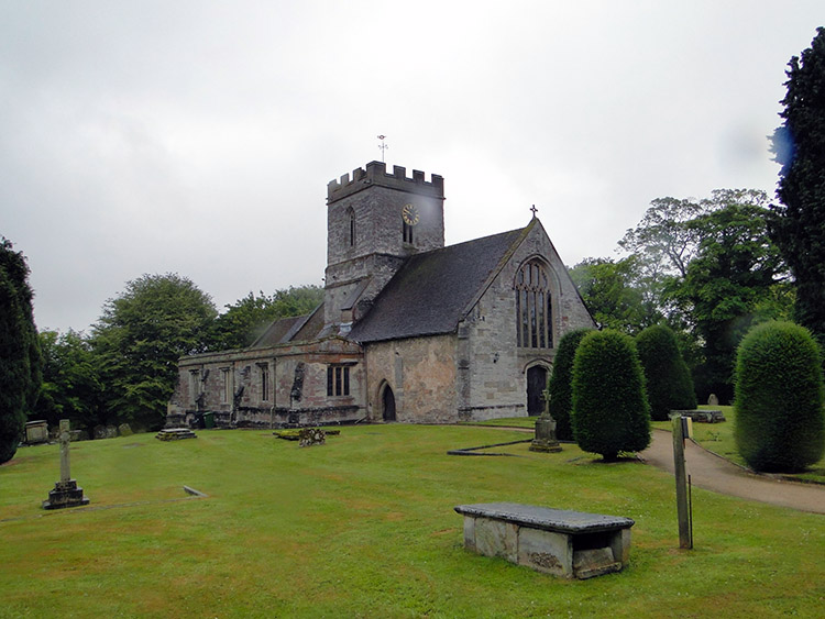
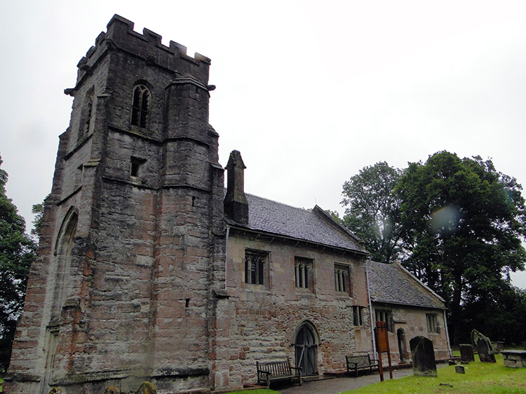 St Michael, Baddesley Clinton
I had stayed the second of two nights at Steve's home in Rugby and after driving me back to Chadwick End he sent me on my way with the words. "Good luck, I will see you in Bath". And that was our plan. I would complete the Midlands section and walk all the Cotswold Way National Trail before meeting up with him in Bath to walk the rest of the way to the Lizard together.
I had the luxury of a light backpack with me for just one more day as Lil, who had been staying at Steve and Jan's with me would meet with me in Stratford Upon Avon for the evening. So with a lighter weight than expected on my back I walked from Chadwick End to the Baddesley Clinton Estate. Visiting the houses and grounds of the National Trust site made the start of my days walking a slow one. I was captured by the lovely setting of the medieval moated manor house which was home to the Ferrers family for 500 years who made it a haven for persecuted Catholics during the Reformation. From the house I visited St Michael's Church, also within the Estate grounds.
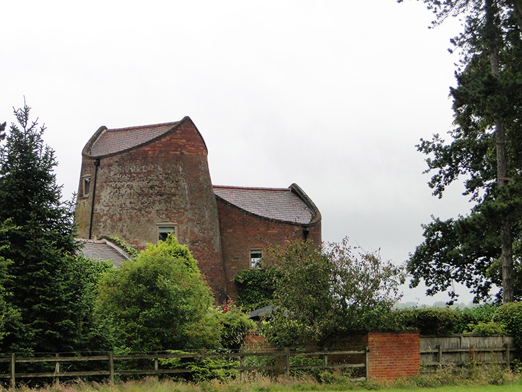 Rowington Windmill
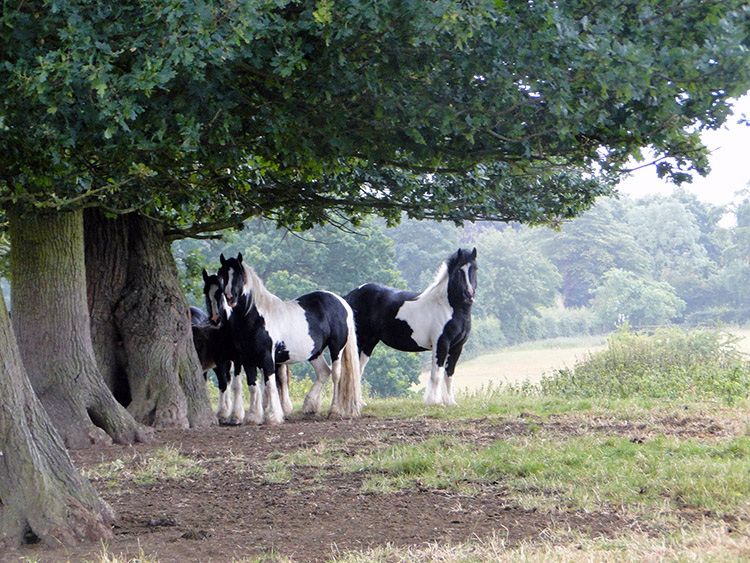 Shires shelter near Rowington
From Baddesley Clinton I followed the Heart of England Way path to Rowington Green where I passed a windmill which was converted into a home in 1978. In its working time the mill was known as Bouncing Bess. The mill, built around 1789 also served as a Prisoner of War dormitory during the 1914-18 Great War. From the mill I crossed a series of fields to Rowington, one of which was occupied by a group of Shire Horses. They were all sheltered under a tree despite the fact it was not raining. Perhaps they could read the weather and were preparing to stay dry? (Note: It did not rain until over four hours later. Thus I will not rely on Shire Horses for accurate weather forecasting!)
 St Laurence Church, Rowington
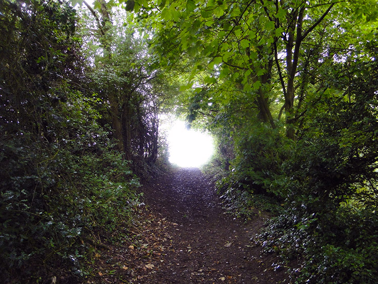 Near Rowington Bridge
After my crossing of fields I arrived at the village of Rowington by reaching St Lawrence Church. From the church grounds I crossed the B4439 Old Warwick Road where an old fashioned road sign embedded into a roadside wall said "To Warwick 6 mile Birm 14". From Rowington I crossed over the Grand Union Canal via Rowington Bridge before crossing a few more fields to reach and cross the M40 motorway near Brookfurlong Farm.
 Yarningale Common
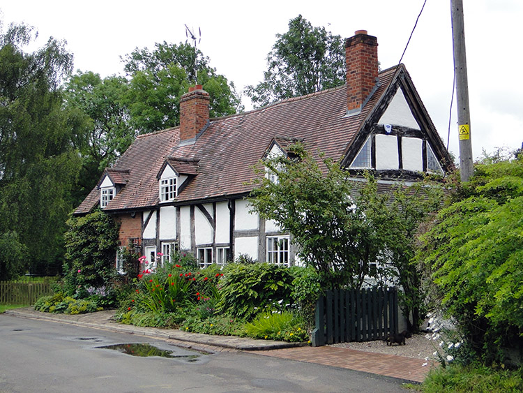 Gorgeous house in Langley
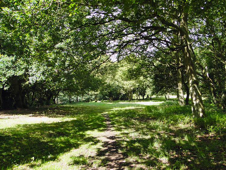
The next few miles of walking were delightful. It had been an overcast morning but by 11.00am the sun had shown its face, periodically breaking through the dense cloud. And it chose to pierce the clouds and cast a bright shadows just as I reached the beautiful setting of Yarningale Common, an area of green pasture and open woodland near to the village of Claverdon. A memorial seat celebrated Ray Hudson, lover of Yarningale. I appreciated the seat for a quick sit down to admire the view. Thereafter I wandered past the western outskirts of Claverdon to follow paths and a quiet road into the hamlet of Langley. The picturesque village was blessed with some lovely timber framed houses.
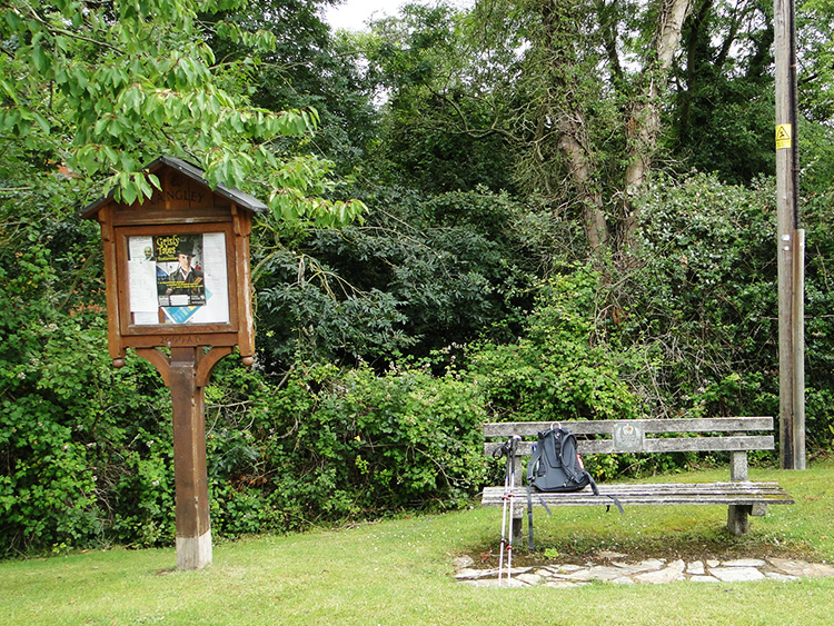 Lunch spot in Langley
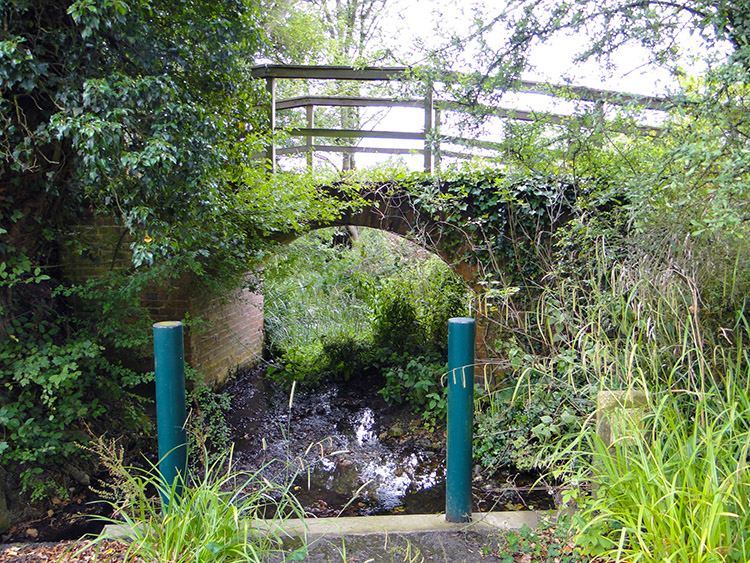 Beck at Langley Green
The setting was so peaceful in Langley. I chose to stop for lunch in the village, sitting myself on a seat in the village which was next to a well built and pretty timber information post. A leaflet advertised "Grisly Tales from Tumblewater" showing at a local theatre. Next to it were parish council notices. I pulled the Times newspaper from my bag and read it while enjoying lunch. It was 12.30pm and I had just over six miles still to cover before meeting Lil in Stratford Upon Avon so I had plenty of time to read and chill. I was back on my way 20 minutes later and having joined it in Langley I was now following the Monarch's Way for the first time. The way soon led me to the edge of Langley Green from where I left the lanes and the roads to begin a long march south across open Warwickshire countryside towards Snitterfield.
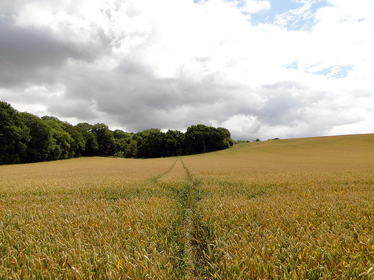 Monarch's Way long field crossing
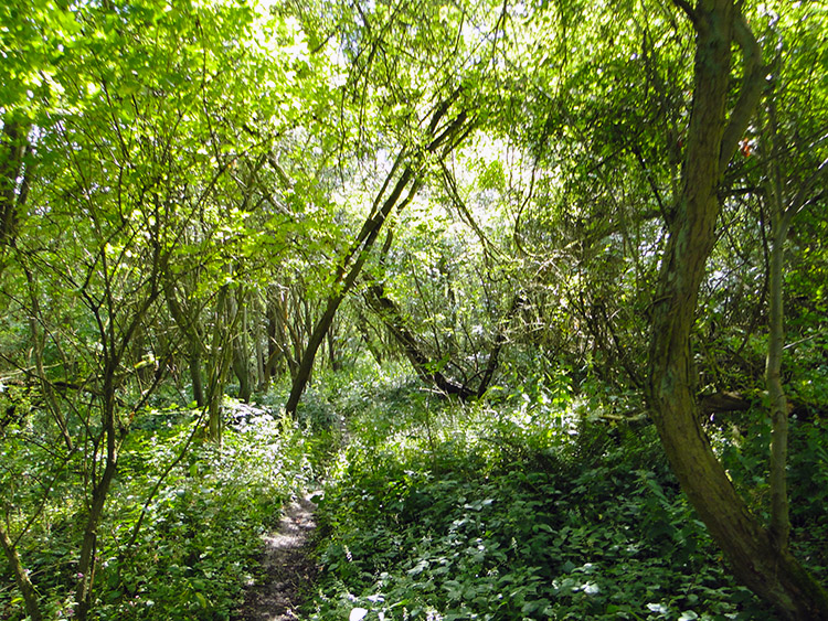 Woodland glade near Snitterfield
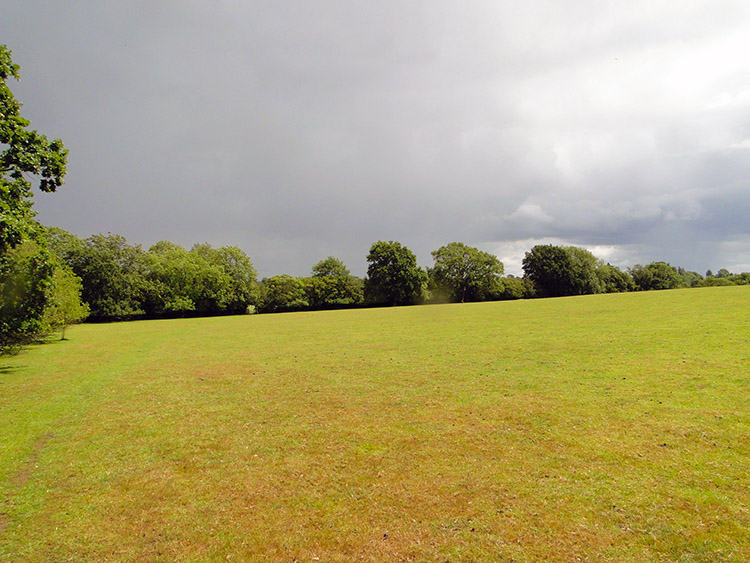
It was a two mile walk from Langley Green to Snitterfield which included the crossing of some very big fields. One of wheat which had the Monarch's Way path crossing the middle was almost half a mile across in itself. I have to admit with fields such as this I usually look as far as I can along the path before putting my head down and walking a chosen number of steps before looking up again. The number of steps is likely to be 100 or 200, the former if on an incline and the latter if on level ground or on a decline. Crossing a boring field or featureless plain land this way makes the passage much sweeter. There was a woodland glade which also broke up the series of quite plain fields. Just one though. Then it was more big fields and with little cover around I feared I would soon get a soaking. The sky was darkening fast.
 Storm approaching
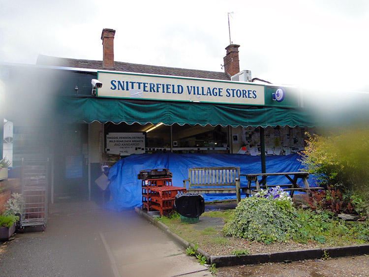 Snitterfield Village Stores
A storm was certainly brewing and I was relieved to see Snitterfield loom into my sight before the clouds burst. I made it to the last field before the village when they did. The storm was sharp from the outset though which caused me to take cover in the trees edging the field rather than make a run for the village. I covered up under the trees for fifteen minutes until the worse of the rain was over and when I reached Snitterfield I walked through a deserted village. Everyone who may have been out in the village had taken cover so I walked through a deserted place. Strong rain had been replaced by steady drizzle but still nobody showed. I passed the village stores which had been voted England's best in 2002. All fruit and veg displayed outside was now covered. A few vehicles were parked in the car park of the Snitterfield Arms but I saw no sign of life at the doorways or through the windows. I walked on all the way down the main street and out of the village without the chance to say a single hello. With no Steve to converse with I might have enjoyed a chat but there was not one to be had. I continued along King's Lane and left it to follow the Monarch's Way through an Orchard before setting my sights on the final push into Stratford Upon Avon.
 Good shot on Welcombe Hills
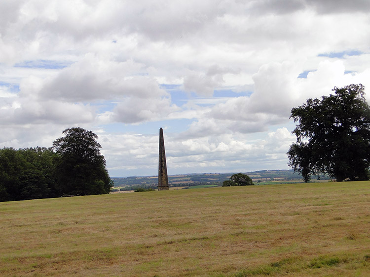 Welcombe Hills Obelisk
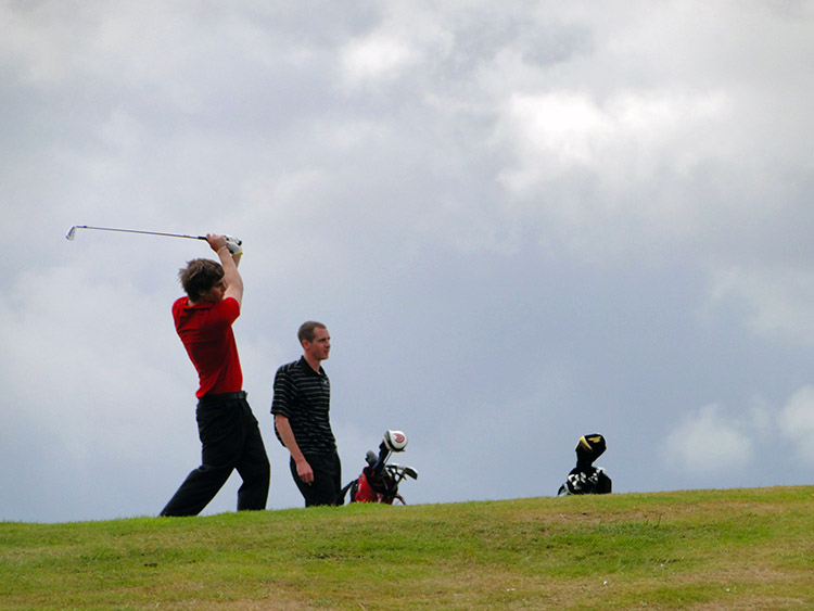
The rain had stopped when I made my biggest climb of my day between Lower Ingon and Welcombe Hills Country Park. The climb was all of 35 metres and I knew that when I reached the top of it I would see Stratford Upon Avon for the first ever time. My short climb was delayed for a while to watch a couple of young men striking balls well on a nearby golf course. It was nice to see people again. After both had made their shots I continued on towards the top of the hill. As I reached it I spotted the Welcombe Hills Obelisk just away from the crest of the hill on the Stratford side. The obelisk was erected in 1876 by Robert Needham Philips in honour of his brother Mark Phillips, an MP who championed many good causes, particularly in education. I walked over to the monument and looked down on Stratford for a short while before heading into the popular Warwickshire town.
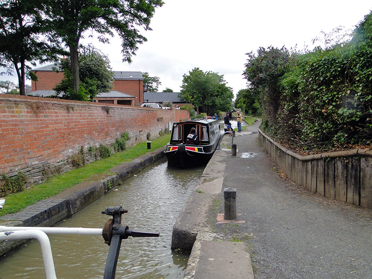 Stratford Upon Avon Canal
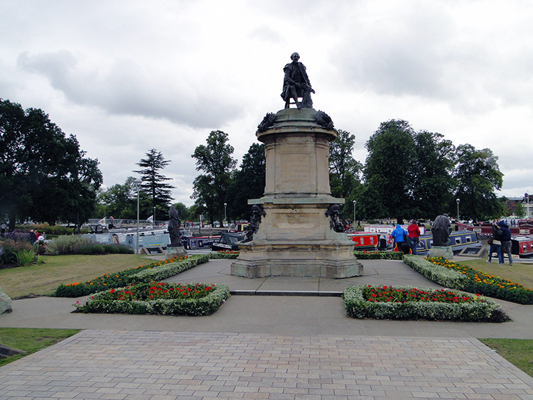 William Shakespeare Statue
At last I got some conversation. Better late than never but after almost 14 miles of walking I met a lady walking her dog at Bluecap Covert which sits on the south banks of Welcombe Hill. It was a short walk and talk of about 100 yards but sweet enough as we chatted about the lovely surroundings of the country park and covert. On leaving the lady I followed Maidenhead Road all the way into the heart of town. The road led me to the Stratford Upon Avon Canal which I followed to Bridgefoot Marina and the end of my day. William Shakespeare looked down at me from a plinth above in the small park area I chose as my finishing point.
Lil joined me in Stratford Upon Avon for the evening. It was the last time I would see her before the end day of my walk in Cornwall and we enjoyed it as best we could with a couple of drinks and a meal. As best we could anyway because she had a painful toothache. All in all it was not the greatest day of my long walk but there were highlights. As I know there always will be. Top marks must go to Baddesley Clinton and the pretty village of Langley gets a thumbs up from me too. And Welcombe Hills Country Park served as a great entry into Stratford Upon Avon. Not bad at all then.


