The Great British Walk
A personal record of my three month walk of the full length of Great Britain from north to south with written journal and photographs. Tracklogs for GPS units and for use with Google Earth are available for download for each stage.
Stage 52: Lichfield to Nether Whitacre
Google Maps Open Source Maps| Statistics and Files | ||
|---|---|---|
| Start: Lichfield | Finish: Nether Whitacre | Distance: 16.4 miles (26.5 km) |
| Time: 6-7 hours | Climbing: 239 metres | Total Distance: 703.8 miles |
| GPX Route File | Google Earth File | About Lichfield |
| Statistics | |
|---|---|
| Start: Lichfield | Finish: Nether Whitacre |
| Distance: 16.4 miles (26.5 km) | Time: 6-7 hours |
| Climbing: 239 metres | Total Distance: 703.8 miles |
| GPX Route File | Google Earth File |
Ordnance Survey Explorer Map (1:25,000)
Summary
The 52nd stage of my walk takes me and Steve from Staffordshire and into Warwickshire. The first half of the walk is spent walking the last miles of Staffordshire through the heart of beautiful Lichfield, across the big skies Swinfen and Packington Parish, over the A5 and then through the quiet parish of Hints to eventually reach the village of Drayton Bassett. We then enter Warwickshire by following the Birmingham and Fazeley Canal to Kingsbury Water Park which helps us to the south side of the M42 motorway and on to our finish in the village of Nether Whitacre. At 16.4 miles this stage also sees me past the 700 miles milestone.(Note: My walk of the Midlands was a part of my Great British Walk from the north coast of Scotland to the south coast of England)
Stage Report
It was set to be another fine day as Steve and I left the Cathedral Lodge Hotel in Lichfield to set off on our walk towards the rural strip between Birmingham and Coventry. The village of Nether Whitacre was our target, just over 16 miles away so we left the hotel as soon as possible after our as early as possible breakfast. Wherever we stayed on the walk we always asked our hosts for the earliest breakfast possible because we wanted to cover the first miles of a new day as early as we possibly could. That usually meant we set a brisk pace to begin with. But not today. In Lichfield we dallied.
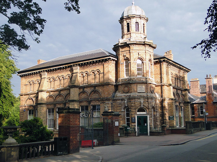 Free Library and Museum, Lichfield
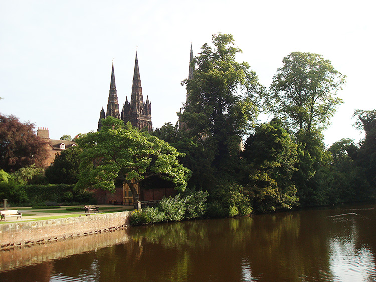 Minster Pool and Lichfield Cathedral
While Steve would have been happy to make haste from the start I wanted to take a final look at the wonderful buildings Lichfield had to offer. First up and just a short distance from our hotel was Lichfield Cathedral. I was particularly interested in the statue line of Saxon and Norman Kings on the west front of the cathedral. In total there are 113 statues on the west front of Lichfield Cathedral, 12 of them being Saxon Kings including Alfred the Great, Canute and Edward the Confessor and 12 being Norman Kings including William the Conqueror, Richard the Lionheart and Edward I, the warrior king know as Longshanks and Hammer of the Scots.
After the inspection of majestic statues at the cathedral we continued on the early morning amble through deserted Lichfield to pass the Free Library and Museum Building and past Minster Pool where a 12th century seven arch bridge lies buried beneath the tarmac. A plaque near Minster Pool told us so. From the pool we walked through the town centre where we had been for a few beers the night before. We passed Doctor Samuel Johnson's birthplace and then we arrived beside a statue of James Boswell, 9th Laird of Auchinleck who was Johnson's biographer. After Boswell our tour of Lichfield was over. We had been walking and stopping off at the sights for one hour. The street market was setting up in the town centre as we left.
 Swinfen and Packington
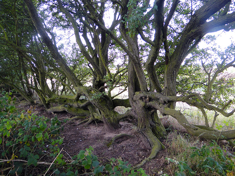 Contortion Hawthorn
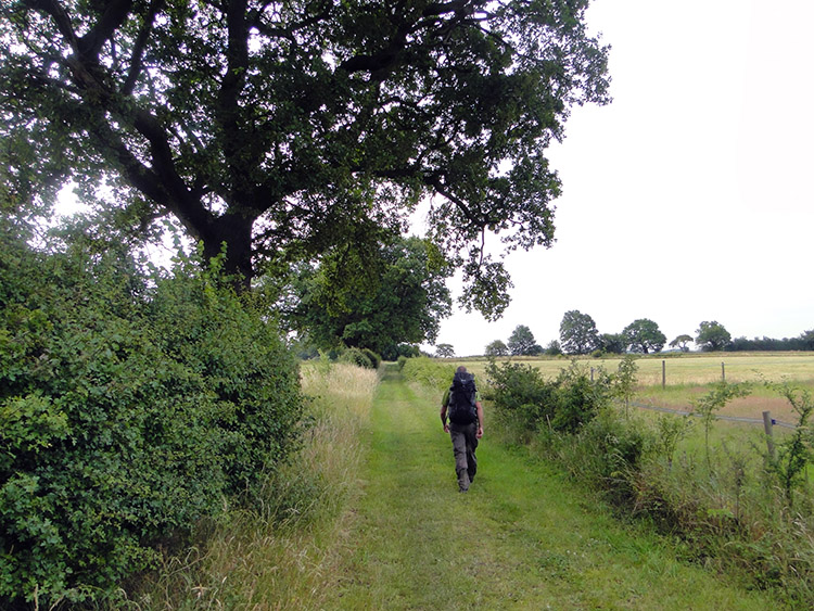
We left Lichfield proper when we crossed over the A38 heading south. As it had been yesterday we were still following the Heart of England Way footpath which barring a few short deviations we would do all day. Once away from the hum of the A38 road everything went quiet. We were crossing quiet and still countryside. The only noise accompanying us was a little birdsong, most of the spring crescendo that fills the mornings of May and June now over with after family upbringing being over and fledging done. We looked across to the right from our path and made out some large buildings. The map told us we were passing Swinfen Hall Hotel and Swinfen Hall HM Young Offender Institution which face each other. Apparently Swinfen Hall Hotel does very well.
 Near the A5 and Weeford
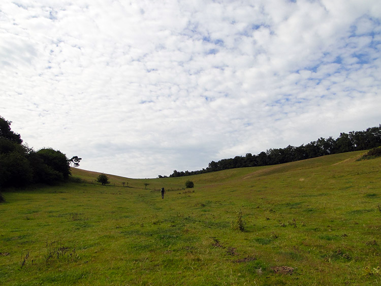 Field beside Gorsey Hill
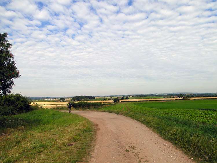
We continued on walking south across the Parish of Swinfen and Packington on a good path with expansive fields to the left and to the right of us. Apart from the odd gnarled Hawthorn hedgerow the walking was wide open. A mackerel sky was accompanying us from above. At a junction of footpaths where the Heart of England Way crossed the Tamworth Lane track and Knox's Grave Lane there was a sign with black lettering on a yellow background. The sign read "Walkers using AA walk books. Diversion rejoins original route . Apologies for any inconvenience caused". Our route seemed fine, it did not apply to us. Continuing on our planned course we passed irrigation pipework with pressurised water spewing from the pipework and then we passed a row of Bee Hives stood besides a field. Then we came to a Department of Transport sign saying "A5 Weeford - Fazeley Improvement. This scheme was officially opened by Dr Stephen Ladyman MP, Minister of State for Transport on 12 October 2005". We then crossed a footbridge over the A5 quickly followed by an on foot crossing over the B5404 to reach Gorsey Hill in the Parish of Hints.
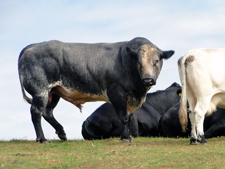 The Bull stares at us
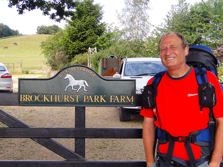 Brockhurst Park Farm
There was trouble on Gorsey Hill. While the Heart of England Way crossed over the middle of a field we exited stage left and scrambled over a fence into the next field. Why? Because on the top of the hill in the field we were supposed to cross we had spotted a herd of cows. And in the middle of the cows who were watching us closely was a very fierce looking Bull. He had fixed eyes on us and maintained the stare. He did not look pleased with us being in the same field at all. So rather than provoke him we hightailed it.
I had been looking forward to the stretch of walking after Gorsey Hill all day. My surname is very rare in the north of England and though fairly common in my father's home county of Sussex it is not very familiar anywhere else either. However, here I was during my Great Britain Walk heading directly to a place called Brockhurst. It was not planned, being a result of making the decision to utilise the Heart of England Way. I had not known there was such a place in Staffordshire. After Gorsey Hill we passed White Owl Farm and then we began our walk along Brockhurst Lane. Soon we came to Brockhurst Park Farm.
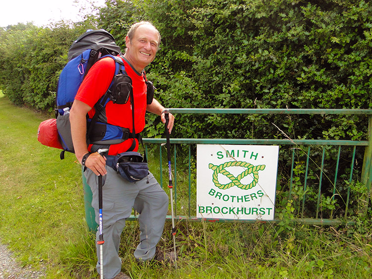 Brockhurst in Brockhurst
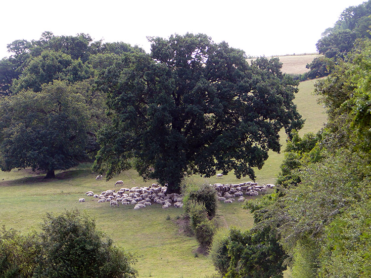 Sheep in the shade
Next place along was Brock Cottage. A plaque beside the front door showing two Badgers was dated 1886. Then we passed a Brockhurst Lane sign and next we came to a sign with a twisted rope emblem with the title Smith Brothers Brockhurst. After that my fun packed adventure on Brockhurst Lane came to an end. Continuing on with the heat of the middle of summer day rising we passed a flock of sheep in a field who were all bunched together in the shade offered by a large Oak tree in the middle of their field. It was still only 10.00 o'clock in the morning.
 The Sunflower Kid
 Strangled by Ivy
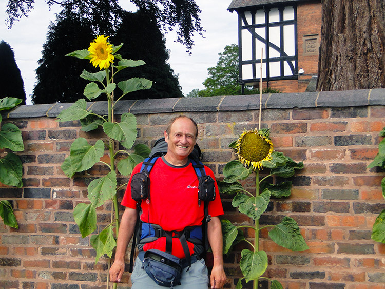
After the fun of Brockhurst Lane which was pristine with houses to covet we had then passed Hints Farm which looked delightful and opulent. Next in line at almost half distance into our walk we reached Great Bangley Farm. Oh it was posh. A long old stabling barn was converted into a row of what appeared to be five immaculate garages. It was not garages at all but in fact a seven bedroom barn conversion. The main house of Great Bangley Farm was something entirely different, a gorgeous part timber framed small mansion. Oh to dream. At least we could pose by the sunflowers outside the garden wall.
After leaving Great Bagley Farm we soon crossed the A453 Sutton Coldfield to Tamworth road and followed Drayton Lane to the village of Drayton Bassett. The village has an interesting history. Established as a Norman village the manor house and estate was first owned by the Basset of Drayton and then the Earls of Leicester and then the Earls of Essex who eventually sold the manor and estate to the Peel family. Robert Peel (1788 – 1850), prime minister and creator of the Metropolitan Police Force for London, lived in Drayton Manor (now demolished and replaced by Drayton Manor Theme Park) and is buried in the vault of the parish church, St Peter. We passed Drayton Bassett without popping into the village by staying on the lane. I wish we had called into the village and taken a look.
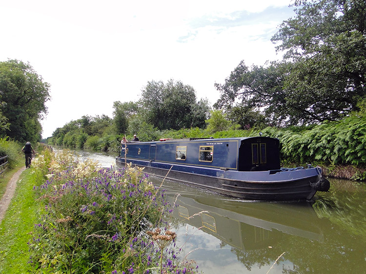 Birmingham and Fazeley Canal
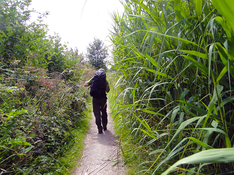 Hemmed in at Curdworth
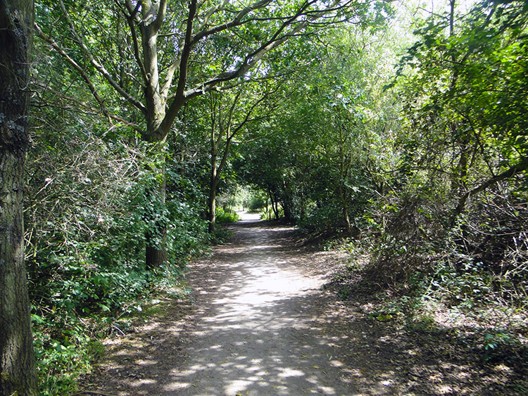
Immediately after passing Drayton Bassett we reached the Birmingham to Fazeley Canal. The next mile and a half walking along the canal towpath was delightful. Some towpaths are well maintained, perhaps too well. In many of those cases when towpaths are widened to make room for cyclists and walkers at the same time the nature living on and close to the towpath is lost. The wildlife, both Flora and Fauna suffers. An example of this is my local stretch of Leeds and Liverpool Canal between Horsforth and Leeds where bank side reeds are cut down and the wildlife scarce. Not so on this wonderful nature reserve of towpath between Drayton Bassett and Curdworth Bottom Lock. Wild flowers abounded by the canal side, unfettered and left alone. Dragonfly darted across the water and along the path. Some bathed in the sunshine on the path too, only moving as we got near to them. Sometimes we could not see the canal despite being on the towpath right next to it. A high line of reeds, sometimes over 10 feet high, blocked our view to the water. Wildlife unfettered. Magic.
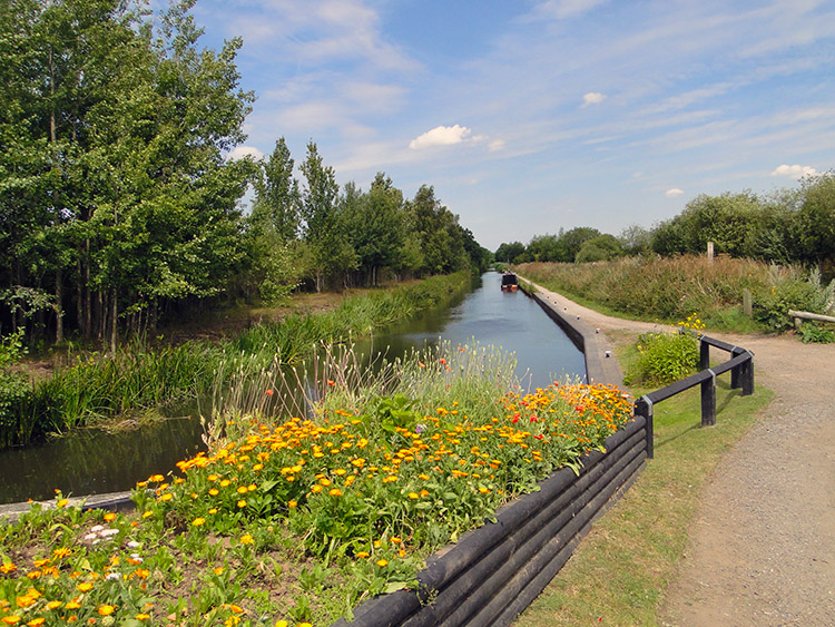 Curdworth Bottom Lock
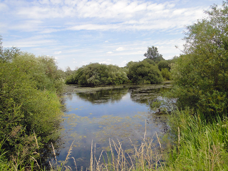 Kingsbury Water Park
All too soon our nature trail came to an end when we reached Curdworth Bottom Lock. Here flower borders were raised and though they were absolutely beautiful they were also formal, unlike the natural forms what we had just left behind. However Curdworth Bottom Lock was to lead us directly into a magical place which though created by man was now left to nature as much as it possibly could. We arrived at the wonderful place which is Kingsbury Water Park. The park has 15 lakes situated in over 600 acres of country park and the first one we came to was a spectacular sight. We had transported ourselves into a water wonderland.
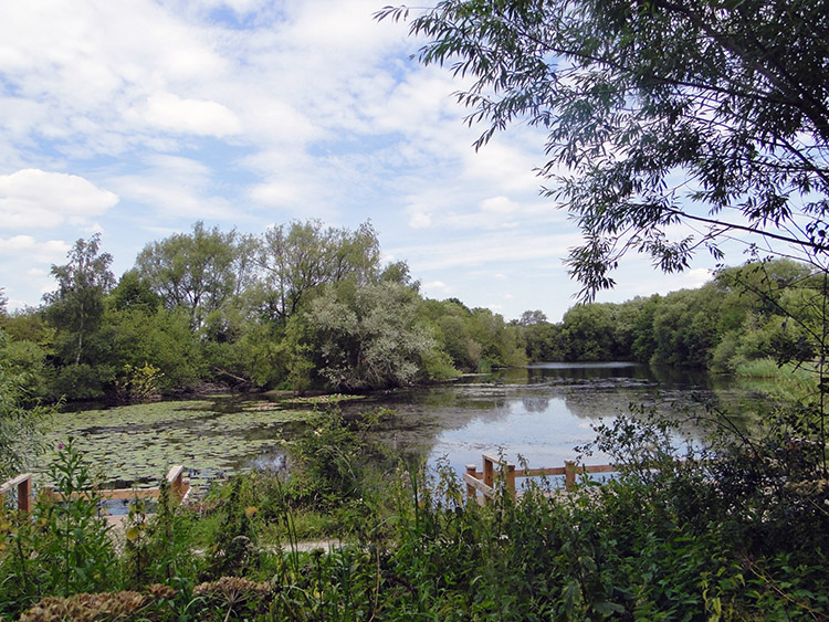 Utter beauty
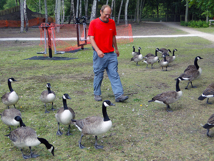 Me and the Geese
As I have mentioned before many of the places visited on my walk were designed and some were accidental. I suppose arriving in Kingsbury Water Park fits between the two. When designing my Great British Walk I had picked the Heart of England way as my route past Birmingham after much deliberation of whether to skirt the city to the east or to the west. Eventually I had decided to save the west side and Shropshire in particular for another time. So the east side route it was and thus Kingsbury Water Park discovered.
We weaved our way through the water park, passing a series of ponds and also passing a railway line. The Echills Wood Railway carries around 30,000 passengers a year. It is a seven and a quarter inch gauge miniature railway built and operated by a group of enthusiasts and dedicated volunteers. After the railway we came across a group of Canada Geese. It was quite humorous when they decided to follow me and Steve around.
 Leafy lane near Kingsbury
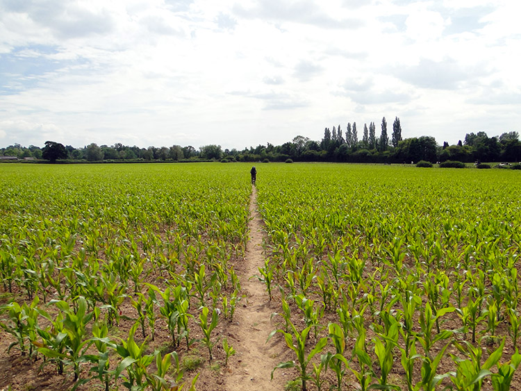 The field to Nether Whitacre
We had passed under the M42 motorway efficiently while walking through Kingsbury Water Park. However on leaving the park by way of country lanes some confusion reigned and a 100 metre long unnecessary walk we took while parallel to the A4097 caused some frustration. "This looks wrong" Steve said. "It does" was my reply. We deliberated for a while whether to carry on to Kingsbury and circle around to where we needed to be or to double back to Marston where we had intended to cross the road at a roundabout. Looking at the scrub getting thicker ahead of us and unsure as to how we could cross the River Tame we doubled back. It was the right move.
And so we reached Marston and followed a road to Coton Bridge. We continued by road to Whitacre Heath and then by road to reach a field which we crossed by a long straight path diagonally across the field. At the other end of the fields our good ladies were waiting for us. Lil had traveled from our home in Harrogate and for the weekend it would be a case of staying at Steve's home in Rugby while being transported to our stage starts and finishes. A nice rest from hotels, bed and breakfasts and tents for a while.
Postscript: Another great day on my long walk in which I passed the 700 milepost. The look around Lichfield in the morning was a fine start indeed. I really enjoyed picking out all the Kings. Then the walk across the countryside of Staffordshire which was highlighted by the visit to Brockhurst Lane was lovely. So rural, so quite and all the better because the Bull stayed put. Then it was a great introduction to Warwickshire by walking along the nature filled canal to Kingsbury Water Park. How great it all was. The last mile of walking, much by road was a bit of a bore but it did not dilute the day at all. Another wonderful stage done and on such a good fine day with lots of sunshine.


