The Great British Walk
A personal record of my three month walk of the full length of Great Britain from north to south with written journal and photographs. Tracklogs for GPS units and for use with Google Earth are available for download for each stage.
Stage 51: Rugeley to Lichfield
Google Maps Open Source Maps| Statistics and Files | ||
|---|---|---|
| Start: Rugeley | Finish: Lichfield | Distance: 11.0 miles (17.6 km) |
| Time: 5-6 hours | Climbing: 297 metres | Total Distance: 687.4 miles |
| GPX Route File | Google Earth File | About Cannock Chase |
| Statistics | |
|---|---|
| Start: Rugeley | Finish: Lichfield |
| Distance: 11.0 miles (17.6 km) | Time: 5-6 hours |
| Climbing: 297 metres | Total Distance: 687.4 miles |
| GPX Route File | Google Earth File |
Ordnance Survey Explorer Map (1:25,000)
Summary
After the troubles of the Staffordshire Way during stage 50 of the walk this 51st shorter stage was without any such problems. We walked from Rugeley to the former Royal Forest of Cannock Chase which provided many of the highlights of the day. From Cannock Chase the route led to Gentleshaw Common, a Site of Special Scientific Interest before we continued across lovely unrestrictive Staffordshire countryside to Lichfield, Staffordshire's premier heritage city.(Note: My walk of the Midlands was a part of my Great British Walk from the north coast of Scotland to the south coast of England)
Stage Report
Ken Brockway joined me and Steve for today's walk between Rugeley and Lichfield. He was one of the readers following the blog I was writing on the Internet to accompany the Great British Walk who also took the time and effort to join me for part of the walk. In doing so he was following the efforts of John Lister and Tim Nobes who had first walked with me during the Lake District phase of the walk. Being a Midlands man who lived in the neighbouring county of Nottinghamshire Ken was knowledgeable of the area which was to proved both useful and illuminating throughout the day.
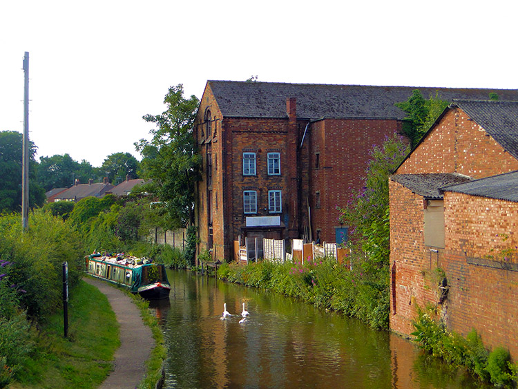 Trent and Mersey Canal, Rugeley
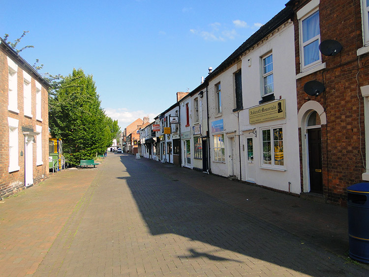 Quiet morning in Rugeley
Having met up and made our introductions with Ken on leaving our hotel we began our days walking by walking back to the Trent and Mersey Canal for a short walk along the waterside before heading back into town. Ken told a little about the history of the canal and the part it played in the growth of Rugeley while we walked along the towpath. He also elaborated on the Bloody Steps story we had first learned when we had arrived in Rugeley. On leaving the canal at the Mossley area of Rugeley we walked through an eerily quite high street. Though it was almost 9.00am there was not a soul in sight as we walked past a row of commercial premise which included Ashcroft Memorials, Rugeley Fireplaces, an Indian Takeaway, a Fish and Chip Shop advertising Pukka Pies and a pub. Continuing on from the town centre we headed south through town, part way of it along the A460 before climbing through streets on the edge of town towards Cannock Chase.
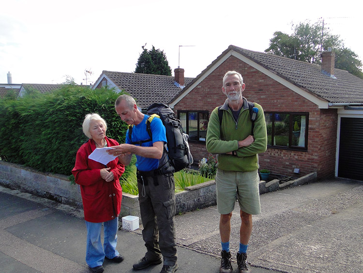 Steve asks for directions
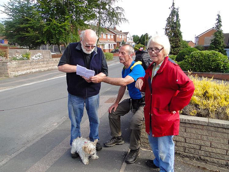 Not sure, he double checks
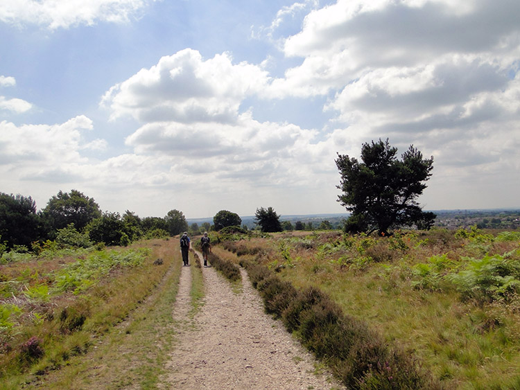
We could not really go wrong with the navigation. With all my Ordnance Survey maps showing the route clearly marked being printed off on A4 paper and with my GPS permanently tracking our line I had now walked almost 700 miles without going off route for any significant distance. Barring a couple of times due to a) complacency between Unapool and Inchnadamph and b) a bridge having disappeared near the England-Scotland border the only navigational problems experienced were getting in and out of towns and villages. They can be tricky to get through in the way planned, one often looking much like the other.
Possibly due to the fact that Steve and I have sometimes walked out of built up areas erroneously, the most memorable on a day we struggled to walk out of Buxton correctly on a walk to Chrome Hill during a Peak District visit, he chose to seek assurance from those with local knowledge that we were walking out of Rugeley and into Cannock as I had drawn it. Ken was getting to know our foibles quickly, remaining stoic and quietly amused as Steve first asked a lady who lived in one of the last most streets we had to walk through if we were in the right place and once reassured we were he then asked a neighbour of the lady for double certainty that we were on the right track and in the right street. Having got his reassurance e then continued up the street and passed about six more houses before walking into Cannock Chase. At the exactly point I had told him we would.
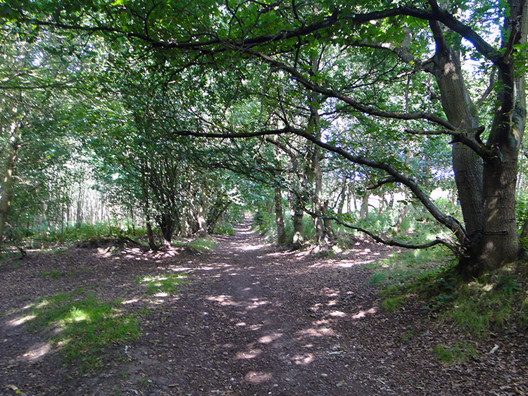 Chetwynd's Coppice
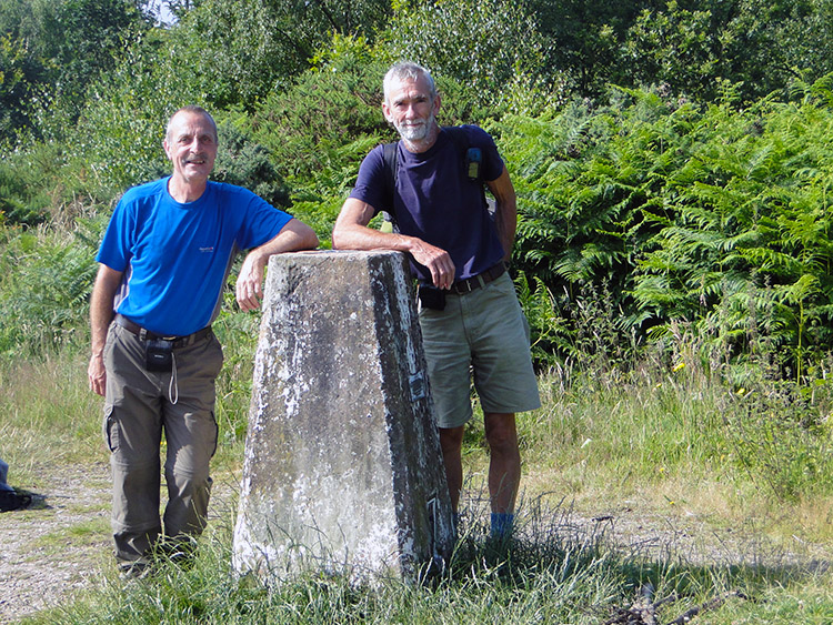 Cannock Chase trig pillar
The first part of Cannock Chase we enjoyed walking through was Chetwynd's Coppice. As soon as we had left our final street in Rugeley we were into gorgeous greenery. Chetwynd's Coppice is an area of wonderful broadwood. Ken explained the history of where we were. Cannock Chase had been an area of extensive coal mining, being active from the late 1800's until 1993 when the Littleton Colliery was the last one to be closed. Chetwynd's Coppice had mines too and by looking at the map I could see we passed close by to disused coal shafts. From Chetwynd's Coppice we continued along a path in an area known as The Glen which was guarded on either side a stretch of younger high pines. This path led us to a trig pillar in Cannock Chase which on reaching it would complete our 130 metre ascent from the canal in Rugeley. The trig pillar proudly stood at 207 metres altitude. Certainly not the highest I would encounter on the Great British Walk but far from being the lowest either. Long since will the trig have been used for its original Ordnance Survey mapping purposes, the line of sight needed for that long since obscured by the woodland which now encircled it.
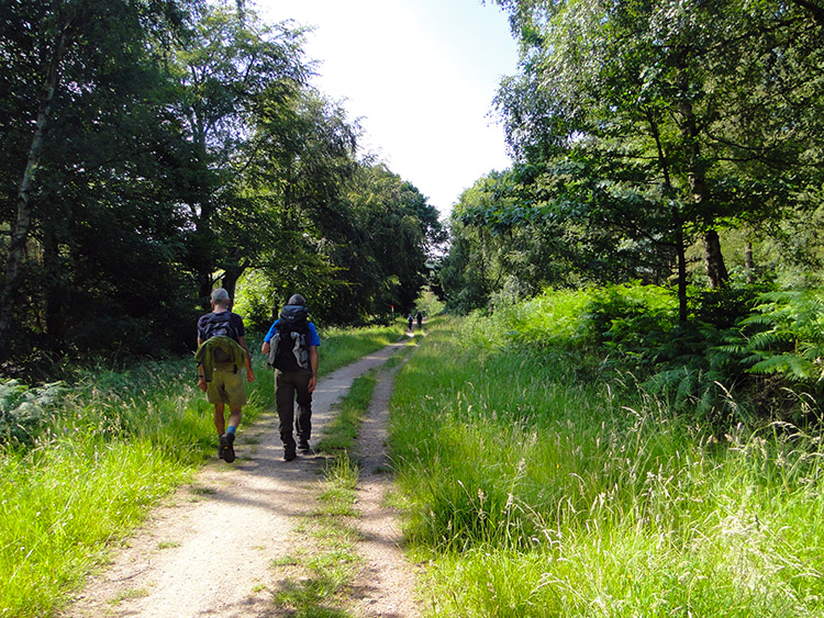 Beaudesert Old Park
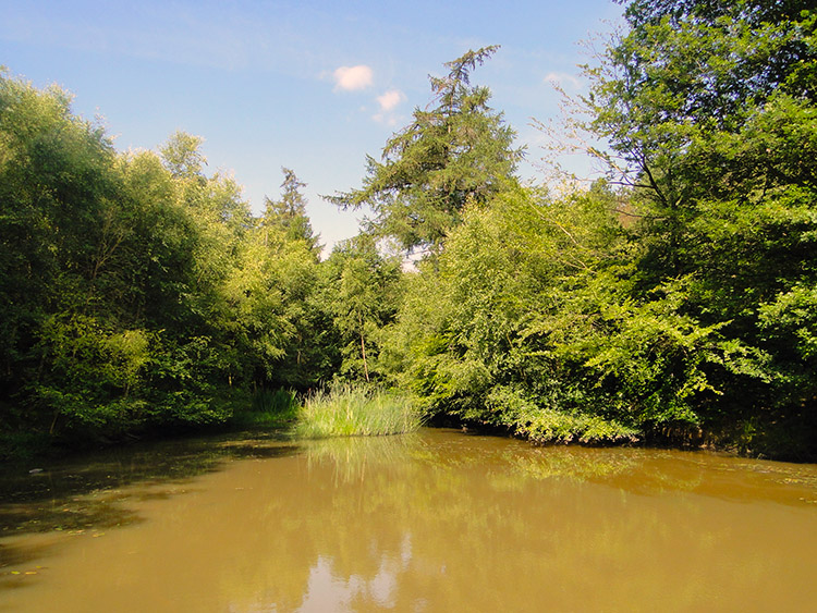 Pond fed by Red Brook
It was a super day and the best morning of sunshine we had enjoyed since being in my home county of Yorkshire. With no wind to speak of and within the enclosure of woodland the going was nice and warm. Ken had been in shorts from the start and though we had all worn light fleeces or sweaters in Rugeley they were all safely stowed away now. It was t-shirts all the way. We continued on from the trig pillar on a slight descent, first along Stile Cop Road and then through Beaudesert Old Park in the heart of Cannock Chase on a course due south. The downhill walk from the trig pillar hit its base as we reached and passed over Red Brook. The brook makes its way from west to east across Cannock Chase and feeds the creation of a number of ponds and water areas including Horsepasture Pools. From Red Brook we then ascended for 60 metres, the last climb of this easier of days to an Iron Age site at the south end of Beaudesert Old Park.
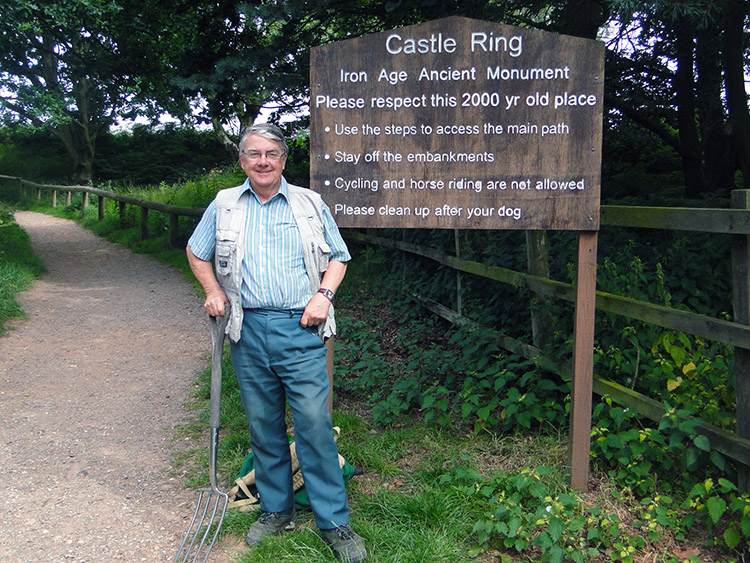 Dennis the digger at Castle Ring Fort
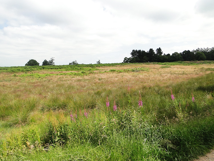 Castle Ring Ancient Monument
A sign said "Castle Ring: Iron Age Ancient Monument. Please respect this 2000 year old place". Next to the sign was a man with a garden fork. We introduced ourselves to him and he introduced himself to us as Dennis, the digger of Castle Ring Hill Fort. He told us he was a member of a local volunteer group who managed and maintained the site and that he was doing work on recent new finds of iron age tools including flint axes. He was clearly very proud of being a custodian and we wished him well with his good work. While we were there we also met a lady walking her dog and on working out her American accent we talked further. She told us her husband worked in energy and was working in Blackpool on some trials of a process called Fracking. I was uncertain to what she was talking about, the phrase being new to me. We wished her a good day to. We walked off and Ken told me more about Fracking. It did not impress me at all, I thought we were over that type of fossil fuel extraction when we had closed the coal mines such as nearby Littleton Colliery.
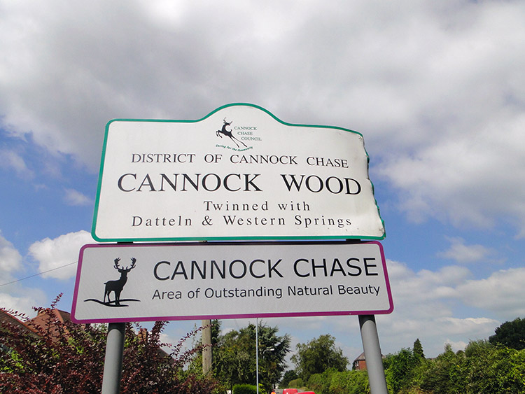 Welcome to Cannock Wood
 Gentleshaw Hill
After our interesting visit to Castle Ring Iron Age Hill Fort, which was sited at the highest point on the walk, we headed from Cannock Chase into the Forest of Mercia. It is amazing what you learn on a walk for The Forest of Mercia is the northernmost boundary of the more ancient Forest of Arden which covered the area when it formed part of the Kingdom of Mercia, and is one of twelve Community forests of England which are focused around the very spot we were stood. I have since found out other English Community forests include Avon in the south west and Tees in the north east.
The Forest of Mercia part of our day took us around the outskirts of Cannock Wood by following the Heart of England Way footpath which was to become a good friend to Steve for the next days. The path led us to Gentleshaw Reservoir. A building told us the reservoir was established in 1930. From the reservoir we crossed a few fields to reach Gentleshaw Hill which was strange as we had arrived at it coming downhill.
 Gentleshaw Common
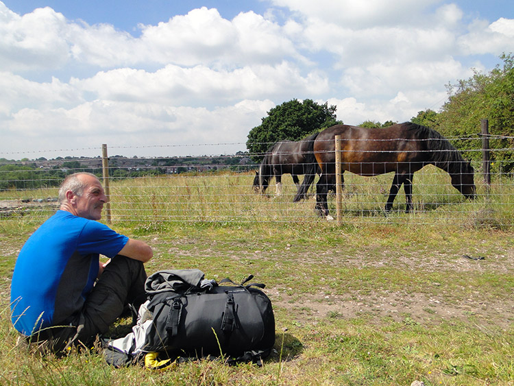 Lunchtime near Boney Hay
From the direction we had come Gentleshaw Hill did not seem like a hill at all. We had not climbed to it but instead descended to it from Cannock Chase in the north. A sign told us that Gentleshaw Common which covered the hill of the same name was 'Healthy Heathland'. The sign added "Follow any of the three circular walks to enjoy the beautiful scenery. The routes will take you through precious lowland heathland, giving you the chance to see rare plants and animals". The routes were marked yellow, green and red, all easy though varying in length. We followed the east line of the green and red routes along Common Side.
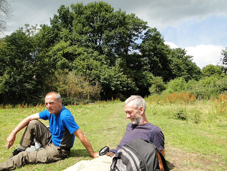
The walk on the east side of Gentleshaw Common took us to Moor View on the north side of Boney Hay. Some horses in a paddock were grazing while enjoying the warmth of the midday so we decided to stop and do the same. It was precisely noon when we stopped. Moor View was appropriately named and the mystery of Gentleshaw Hill was solved as we relaxed during lunch. To the west, south and east the land dropped away quite distinctively showing that we were now quite clearly on the top of a hill. It was only looking back to the north and to higher land that it became clear that Gentleshaw was a south outlier of Cannock Chase. Gentleshaw Hill was a lovely lunch spot.
 Countryside near Cresswell Green
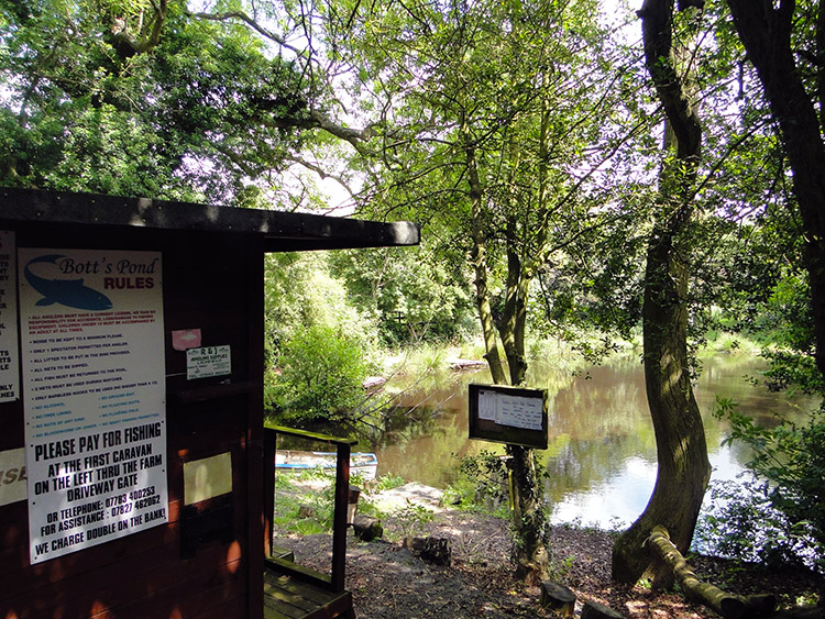 Bott's Pond
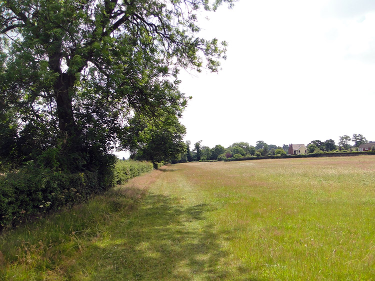
From Gentleshaw Hill we headed downhill on a gentle gradient which was the topographical shape of the walk for the rest of the day. The walk became an amble rather than a ramble. We had just about five miles still to do in the day and as it was a perfect mid July afternoon I was resolved to enjoying it to the maximum. Steve and Ken got to know each other better by walking in tandem ahead of me while I tarried behind them, slowing progress as best I could without becoming a bore. Fortunately we found things to interest us along the way
As we walked along the road towards Creswell Green it soon became apparent we were walking through a big cat park. First we spotted an impressive tree house. Was that the home of Tarzan? Then we saw a Leopard. And then a Cheetah. And then we came across a Jaguar. The only difference with these individuals to any other is that all the big cats were soft cuddly toys. The eccentricity of the English has no bounds. The line of animals took us nicely to Bott's Pond, which is allegedly Staffordshire's Premier Course Fishery. Soon after that we came to Cresswell Green which in little more than the Nelson Inn sat at a crossroads. It was quiet at the pub. Everyone must have been fishing.
 Broad Bean Avenue
 Abnalls Lane
The next phase of walking took us along a series of roads, lanes and fields as we approached Lichfield from the north west. We stuck to the course of the Heart of England Way throughout. While crossing some of the fields I thought of food, being partial to a Broad Bean which one of the fields was full of. Alas it was too early to crop them. Then we came to a road of much interest. Abnalls Lane is an Holloway in parts, a sunken road edged by high hedgerows with intricacies of tree roots edging down the side of the bank to touch the road and stretches of sandstone cliffs with peoples names etched into them. We also walked past an Historic England Monument on Abnalls Lane, a Medieval moat surviving as an earthwork and the possible location of the manor house of Thomas de Abbenall in 1294. A shame we did not see that though some of the names carved in the nearby sandstone may have dated as far back.
 Beacons Park, Lichfield
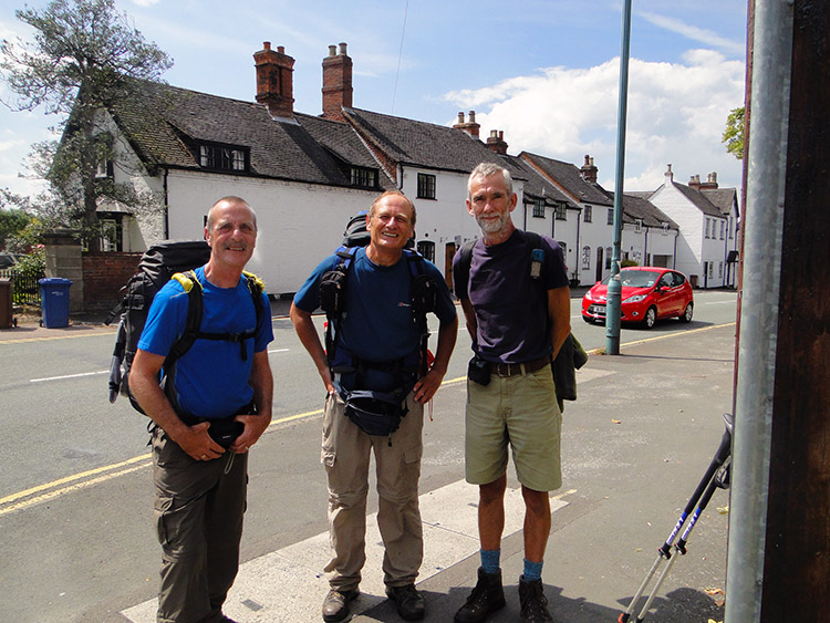 Steve, me and Ken in Lichfield
Just before we left Abnalls Lane we passed the entrance to Maple Hayes Hall, a specialist school for children aged 7 to 17 with Specific Learning Difficulties/ Dyslexia. Well done there. We swaggered into Beacons Park on the west side of Lichfield. Now within sight of the city cathedral we parked ourselves down on the parkland grass for a chill out. Despite tarrying our walk it was still very early in the afternoon, just 1.30pm. We managed to sit ourselves down for a full fifteen minutes before the itch of walking put us to our feet again. We walking into town to finish our walk at just before 2.00pm. Thanking Ken for his company, his courtesy and his support we wished him farewell on his return home. Another friendship was formed.
A footnote about Lichfield. In the afternoon we explored the town and both Steve and I found it gorgeous. Though the town centre was much like any other the historic and grander buildings were very attractive, buildings such as Samuel Johnson Birthplace Museum and the Free Library and Museum. None could rival the gem which is Lichfield Cathedral. It is the only medieval cathedral in England with three spires and it is stunning. Naming the royalty set in stone at the front of the Cathedral was one of the special non-walking related moments of my walk.


