Offa's Dyke Path National Trail
A personal record of my walk of Offa's Dyke Path National Trail with written journal and photographs. Tracklogs for GPS units and for use with Google Earth are available for download for each stage.
Journal, Photographs and Download Files
Stage 8: Kington to Hay-on-Wye
Google Maps Open Source Maps| Statistics and Files | ||
|---|---|---|
| Start: Kington | Finish: Hay-on-Wye | Distance: 15.0 miles (24.0 km) |
| Time: 7-8 hours | Climbing: 638 metres | Rating: Hard |
| GPX Route File | Google Earth File | About Offa's Dyke |
| Statistics | |
|---|---|
| Start: Kington | Finish: Hay-on-Wye |
| Distance: 15.0 miles (24.0 km) | Time: 7-8 hours |
| Climbing: 638 metres | Rating: Hard |
| GPX Route File | Google Earth File |
Ordnance Survey Explorer Map (1:25,000)
OL13 Brecon Beacons/ Bannau Brycheiniog: Eastern Area
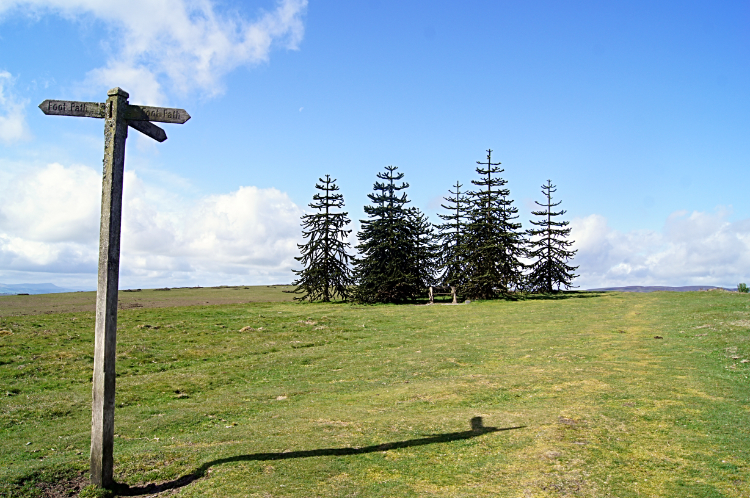
The Walk: From my early morning Facebook post, 11th May 2015: Good morning from Offa's Dyke. Stage eight takes me 15 miles from Kington to Hay-on-Wye. Its an uphill walk from the beginning to Hergest Ridge, made famous in the 1970's by being used as the title of a Mike Oldfield album. The climb is 250 metres from Kington to the trig pillar at 423 metres and then another three metres to the true summit at 426 metres. That's odd. From Hergest Ridge its a descent to Gladestry then across country to the next climb, Disgwylfa Hill. Not too demanding by the looking at the map. Across rolling border country once more from Disgwylfa Hill to my destination, the final mile along the banks of the Wye. The weather forecast is for a front to pass over then clear in the afternoon. It's dry now, I hope it stays that way. Incidentally after yesterdays hardest stage of all I have just woken from 10 hours of deep uninterrupted sleep. Feeling revived.
 Hergest Ridge
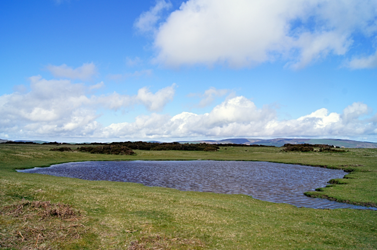 Tarn on Hergest Ridge
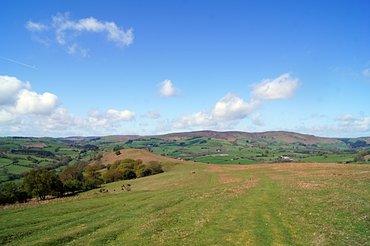
Kington was waking up as I walked out of town at just after 7.30am to begin the eight stage of my walk from Prestatyn to Chepstow. I passed the Swan on the Square and the Royal Oak, the two inns had enjoyed drinks in during my night in Kington. Bustling then, they were asleep now. Once clear of the town I followed Ridgewood Road towards Hergest Ridge in a line almost true west. I would not turn to my usual course of southbound until after the summit, two miles and 230 meters of climbing from my setting off point. The climb was steady throughout, no deviations at all from the angle of climb from start to finish. On the way up to Hergest Ridge I passed a number of interesting places such as Church of St Mary, Kington Parishes and Hergest Croft Gardens. Soon after the site of the gardens I passed the highest house up Ridgewood Road and soon after that the tarmac road ended. A few cars were parked here already, at before 8.30am. Dog walkers in the most, I met and greeted a few on the way up the wide closely mowed grass fairway leading directly up to the summit. As I climbed I welcomed what I was seeing happening to the sky. It has been the usual cloudy morning I had been greeted with on most days of this walk thus far but this time the cloud was disappearing early. Right on cue the sun came out at the summit of Hergest Ridge. And in the main I knew it was staying. This was my best day for sunshine yet on my Offa's Dyke Path. I knew that already. At nine o'clock in the morning.
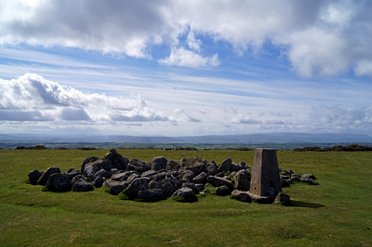 Hergest Ridge Trig Point, 423 meters altitude
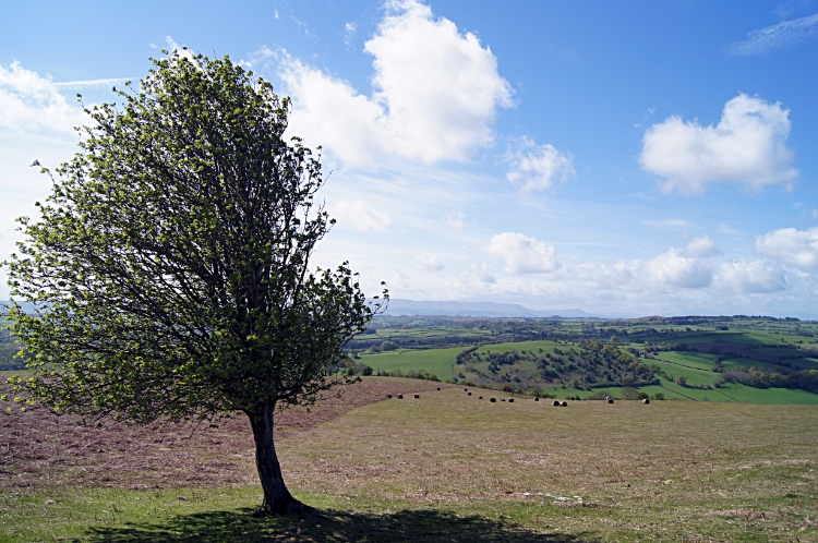 Windswept but surviving
Hergest Ridge. I never knew anything about it before I had started planning this walk other than it being the title of a Mike Oldfield album which included the lyric "if you feel a little glum, to Hergest Ridge you should come. In summer, winter, rain or sun, it's good to be on horseback.". While not on horseback I was standing at the trig point on the very top of the hill and looking out to tremendous views in all directions. By no means was I glum. It was magical, quite stunning and no doubt the warming morning sunshine helped in my emotions of dumbstruck awe. The Shropshire Hills, Radnor Forest, the Radnorshire Powys Hills, the Black Mountains. They were all there to see. Strangely at top of the hill is a circle of nine Monkey Puzzle Trees. Weird if you don't know why so I looked into it. The answer is that Dick Banks of Hergest Croft Gardens which I had passed on the way up planted the nine monkey puzzles trees on top of the hill, having seen similar trees growing on mountain tops in Chile in the early 1990's. So there you have it. Oh, and before I leave the summit of Hergest Ridge another point I must mention is that there is the site of a disused racecourse up here too. That may be why Mike Oldfield mentioned horseback in his song lyrics. Now we can head down from the hill.
 View to Colva Hill
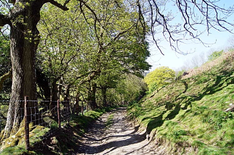 Lane leading to Gladestry
From the trig point I walked down Hergest Ridge in a carefree manner. Happy to be up in the great British countryside on a bright and warm late spring morning with not a care in the world. It was the most gorgeous morning. You can wander at will on Hergest Ridge, a wide open space and so I did. It was only when I got lower down the hill when I was obliged to take the designated path leading to the village of Gladestry. The path cut to the left of a small hill on the west edge of Hergest Ridge and grass ceded to hard stone on the lower approach to the village. A bank to the right and spring green trees to the left.
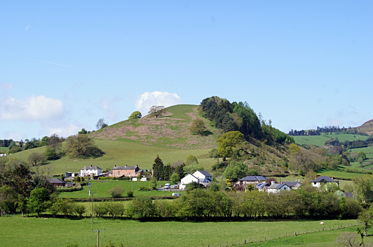 Gladestry
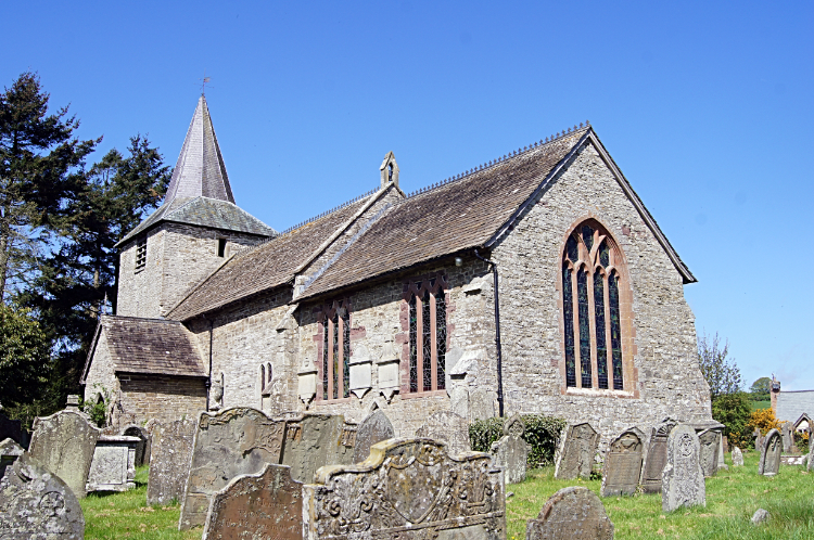 St Mary, Gladestry
Gladestry is a pretty little village. The setting of the image picture on my approach from Hergest Ridge with the village having the backdrop of Glan-yr-afon hill is the stuff of picture postcards. Once in the village I arrived at some impressive buildings. The Church of St Mary with its short pointed spire was one. The Royal Oak Inn, no doubt a common name in these parts, was another. The rows of terraced homes fronting the main street through the village were very pretty too. Not a drop of litter to be seen. This village is cared about by the inhabitants and that was demonstrated by a gentleman tending his garden as I walked past. Courtesies were passed between us and soon after I was gone. It was a short transient visit to Gladestry for me but I was all the better for it. I continued on my way from the village, turning from west to my more familiar south bound course and headed back into the sumptuous countryside.
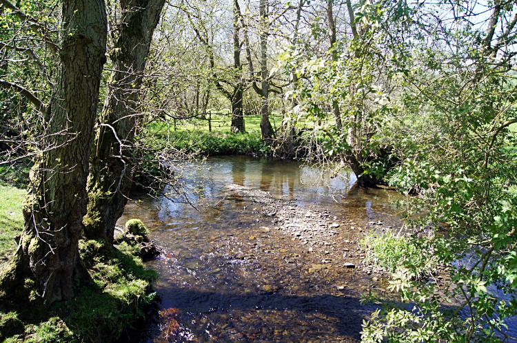 River Arrow at Newchurch
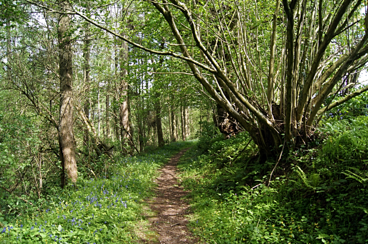 Bettws Dingle
More pretty country lanes and field crossings were enjoyed after my walk through Gladestry, all wilder than lowlands as I was walking across uplands without hills of around 300 meters elevation. Soon enough though I did come to another named moorland hill which was heralded by a sign which read "Disgwylfa Hill is a gift from god, or whomever you believe in, Please cherish it as we do, Don't Dump your scrap or tin". That's telling them, a much nicer way to say don not rubbish our hill. Disgwylfa Hill is a wide open hill, much like Hergest Ridge but a little more unkempt. Higher uncut grasses, dried to straw white were off the paths. Semi-wild horses managed the hill. They were friendly enough, allowing me to get up close and say hello. From the hill I descended into the village of Newchurch, no more than a scattering of a few houses and a church and soon after the village I arrived at a footbridge over the pretty River Arrow. I crossed the footbridge and settled down on the lush dried grass of a field for lunch. Such a nice setting it was. After lunch I walked dingles, holloways, fields, lanes and then I crossed another small hill called Little Mountain to join a country road at Cwm-yr-eithin. A mile of road walking followed, not ideal as the pounding on tarmac heated up my feet. Just in time I left the roadside to begin the delightful walk through the woodland of Bettws Dingle. It was lovely, rich in the smell of fresh grown wild garlic and Bluebell brilliant blue. Bettws Dingle also led me down towards the River Wye, a river I had never walked beside before.
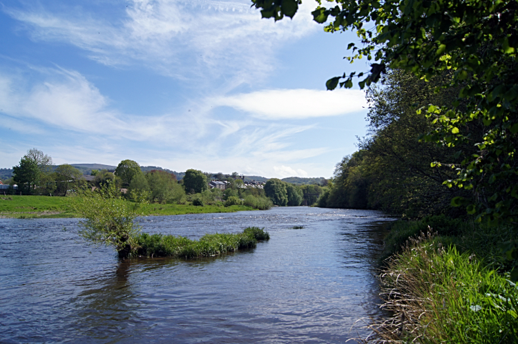 River Wye
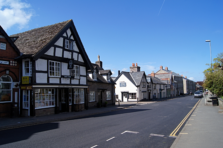 Hay-on-Wye
A short stretch of walking alongside the busy A438 was an inconvenience but once away from the road and down by the river I was thrilled. The River Wye is one of Britain's great rivers, born on the high mountain of Plynlimon in the Cambrian Mountains. From its source it travels 134 miles to the Severn Estuary and from here just north of Hay-on-Wye I will be heading in the same direction as it, meeting it now and then and finishing my walk near to where it finishes its way too. It was already a big river when I joined it after leaving the A438. Some people were canoeing along the river. Others were sitting beside it. Some more, lie me, were walking beside it into Hay-on-Wye which was my finishing point for today. The largest town on my walk, famous for its literary heritage and for all bibliophiles had something else available which I now coveted . It was hot. I was hot. I was hungry too. So when I saw a coffee shop with people sat outside and a spare table available I quickly headed for it. Spot secured I was soon sat drinking coffee and eating cake. Magic.
Footnote from a late evening Facebook post, 11th May 2015: A sunny day at last which made the tremendous views available all the better. Hergest Ridge was the unforgettable highlight but there was much more besides including the approach along the River Wye into Hay on Wye. I met a couple of very friendly farmers too, both managing sheep in the fields I was crossing. A couple of horses on Disgwylfa Hill also came over to me as I crossed the moor. Red Kites soared above in their graceful soaring flight to remind me of home where they are also found.


