Offa's Dyke Path National Trail
A personal record of my walk of Offa's Dyke Path National Trail with written journal and photographs. Tracklogs for GPS units and for use with Google Earth are available for download for each stage.
Journal, Photographs and Download Files
Stage 9: Hay-on-Wye to Pandy
Google Maps Open Source Maps| Statistics and Files | ||
|---|---|---|
| Start: Hay-on-Wye | Finish: Pandy | Distance: 15.8 miles (25.4 km) |
| Time: 7-8 hours | Climbing: 726 metres | Rating: Hard |
| GPX Route File | Google Earth File | About Offa's Dyke |
| Statistics | |
|---|---|
| Start: Hay-on-Wye | Finish: Pandy |
| Distance: 15.8 miles (25.4 km) | Time: 7-8 hours |
| Climbing: 726 metres | Rating: Hard |
| GPX Route File | Google Earth File |
Ordnance Survey Explorer Map (1:25,000)
The Walk: From my early morning Facebook post, 12th May 2015: Good morning from Offa's Dyke. It is the highest stage of the walk today as I cross the Black Mountains. The height will reach over 600 metres but unlike the Clwydian Hills and Clun Hills which were energy sapping ups and downs it looks like I enjoy one thrilling rolling ridgeline for around 11 miles. As the stage is 15 miles from Hay on Wye to Pandy that means I will spend most of the day looking at great views. I should see my old favourite Sugar Loaf near Abergavenny and more mountains I crossed in my Welsh Coast to Coast two years ago. I hope it's fine up there. It is raining as I write.
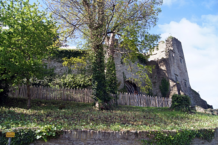 Hay Castle
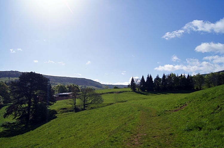 Approaching Upper Danyforest
The rain I had mentioned in my early morning Facebook posting had passed while I had breakfast. I walked out from my accommodation to a beautiful morning in Hay. The sky was blue, the air was warm. All good as far as I was concerned. It was 8.15am as I wandered around the town looking for a convenience store and while doing so my attention was diverted by coming across Hay Castle. I had a walk around the outside of the castle before locating a nearby convenience store, stocking up for two days walking and then setting off from the town heading south towards the Black Mountains. Once clear of Hay-on-Wye the walk to Pandy began with a series of low lying field crossings to a copse on a small knoll hill near the site of Cusop Castle. From the knoll, a mile into my 16 mile day I climbed steadily over more pasture fields to Upper Danyforest where the both the setting and atmosphere changed. I was climbing to rougher ground as the clouds rolled in. The sunshine of early morning had been dismissed and the cloud brought in by cool winds chilled me. Even while climbing; it was a stiff cool breeze. I thought to myself "I hope it is not like this up on the Black Mountains". At a sheltered field side spinney soon after passing Cadwgan Farm I even huddled down and put on my coat while watching a storm cross Hay Bluff on the north edge of the mountains.
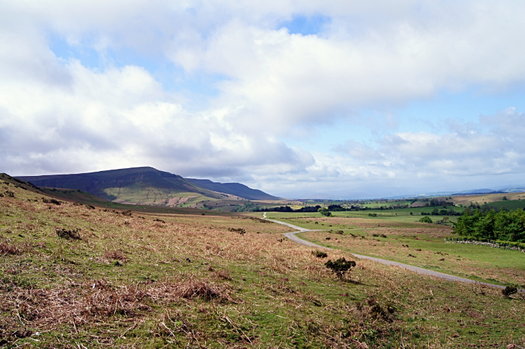 Approaching the Black Mountains
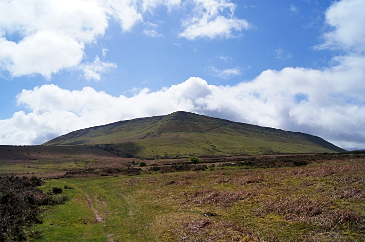 Hay Bluff
I watched the storm pass overhead for five minutes and then, lo and behold and as if by magic, the clouds brought in with the storm streamed away as quickly as they had arrived. The sun came out and the day calmed again. Wrapping up my raincoat and consigning it back to the rucksack I picked myself up from my temporary shelter and walked earnestly towards the mountains. I so much wanted to get there while the sun still shined and cursed every cloud as it approached my piece of sky. By fortune the stretch of walking from Cae'r bwla to Hay Bluff was enjoyed without any more weather squalls coming over. In fact it was very enjoyable, the awesome view of the north-most outliers of the Black Mountains providing a terrific incentive to approach.
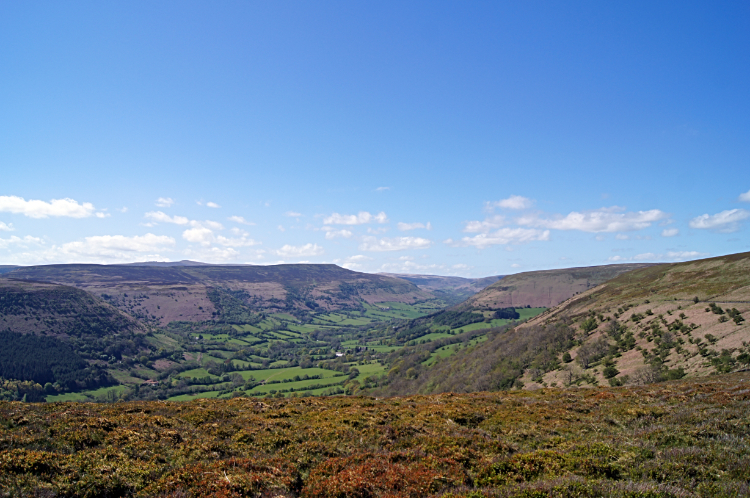
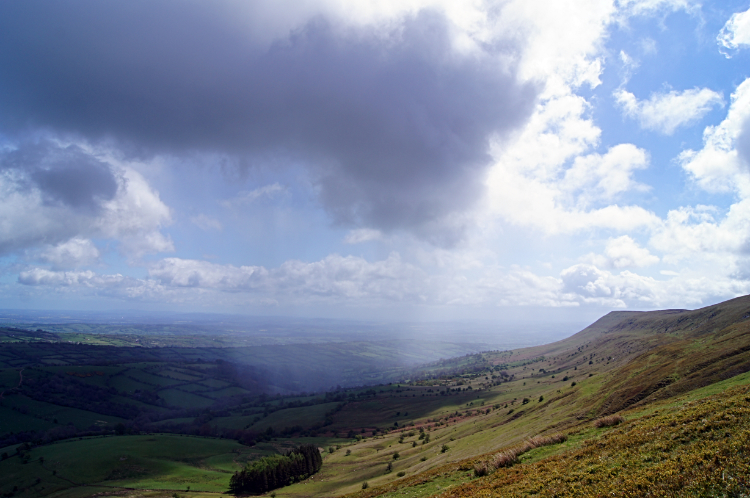 Storm in the valley
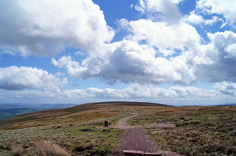 On top
At Hay Bluff I started the climb, a little more steeper than the approach. I was climbing by the Offa's Dyke Path route on the east side to Ffynnon Beacon and while doing so I watched a herd of Welsh Ponies grazing further up the slope. There were twelve of them, ten adults and two foals, chomping away without a care in the world. The path did not get too close to them at any point. They probably knew that having seen plenty of walkers pass this way before me. Halfway up the banked approach at Ffynnon Beacon I watched a storm threading its way down the valley below, in much the same way I have seen tornadoes rush through the mid states of the USA on the TV. "Glad I am not under that" I mused. Climbing further to the top I came across another smaller group of Welsh Ponies, this time half a dozen which were crossing my path line as they grazed. I walked right through the group which included a youngster without a flicker of emotion from them. They were not bothered about me at all. I really appreciated that. Soon after passing the ponies I arrived at the top of Hay Bluff. Clouds were rolling over the mountain but they were not looking as intimidating now, more fluffy white than dark grey.
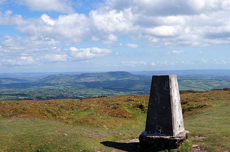
 The second trig of three, half way along the ridge
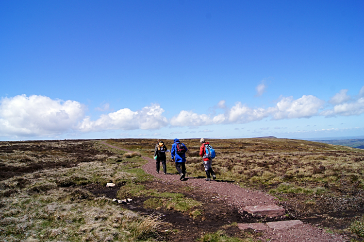 Day walkers
At precisely five miles since walking from my accommodation in Hay-on-Wye I plateaued out on Hay Bluff, the north tip of the Black Mountains east-most upland massif. Ahead of me was the Hatterrall Ridge, a ten mile long walk on the spine of the slender upland. Not a narrow ridge in the sense of Striding Edge in the Lake District or Crib Goch in Snowdonia but a ridge 300 meters wide at its narrowest points and up to a kilometer wide at places such as where the outlier known as Black Hill (cat's back) is adjacent. Soon after setting off along Hatterrall Ridge I spotted groups of walkers further south along the ridge. Some were in twos and some larger groups. I guess all were having as much fun as me on this top-land, accompanied by clearing skies. My walk along the ridge was great from the start, the path being very well maintained with imported slabs covering the areas more prone to foot erosion. Some stretches of slab paving were quite lengthy. Otherwise the paths of compacted sandstones and mudstones made for a firm but gently springy progress which was perfect for me.
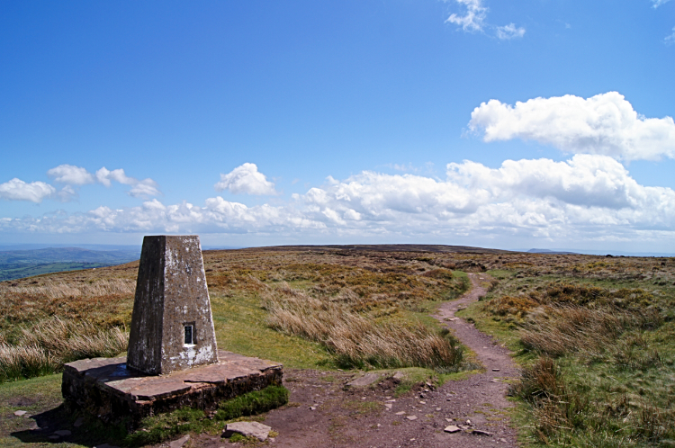
 View from the south-most trig pillar
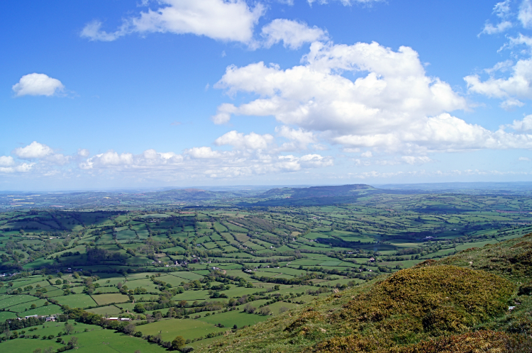 Monmouthshire and Herefordshire
Trig points along the length of Hatterrall Ridge made convenient marker points for me to gauge exactly how far I had to go from one to the next. Apart from these and the occasional boundary stone or cairn the terrain was pretty much the same across the entire ten miles. However, after passing Black Hill which acted as a view blocker and when the ridge path narrowed most the revealed views to the Golden Valley and further east into the heart of Herefordshire were incredible. And to Monmouthshire too. All were quite stunning. Some of the best views I have ever seen from mountains; I can attest to that. I guess it was the cleared skies after the freshness of storms had passed which made the views so distant and so illuminating. They were truly spectacular and unforgettable. WOW. Without a doubt. I stopped by the south-most trig point on Hatterrall Ridge, walked to the edge of the even ground, took off my rucksack and sat down to look out over the scene. For half an hour. I could hardly tear myself away such was my enchantment. I was hypnotised by the view. It took all of my effort to get up and leave the scene to finish my walk. Not before this memory was banked though.
 The Black Mountains
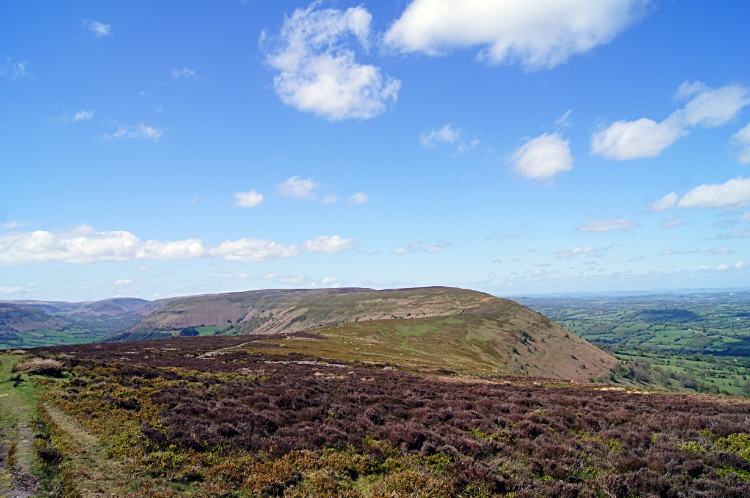 Hatterrall Hill
As I neared the south end of Hatterrall Ridge familiar sights came into view. Two mountains of the Brecon Beacons captured immediate attention, first Sugar Loaf a particular favourite of mine, often climbed when visiting family in Usk. Second was the Skirrid, a famously local mini mountain with a big reputation. I would be passing close to the Skirrid tomorrow. For now I reached Hatterrall Hill at the southern edge of the ridge after which I followed Offa's Dyke Path coupled with the Beacons Way down from the mountain top on a southbound course towards Pandy. On the way down I passed a corrugated barn of which this was written on the side "Today I want the sky, The tops of the high hills, Above the last man's house, His hedges, and his cows, Where, if I will, I look, Down even on sheep and rook, And of all things that move, See buzzards only above:— Past all trees, past furze, And thorn, where naught deters, The desire of the eye, For sky, nothing but sky". By Edward Thomas, a poet who lost his life in the Great War. After my remarkable day on the Black Mountains I thought the poem was most appropriate. Soon after I was done for the day. What a day it was.


